

Illogan - Godrevy (Tehidy Woods)
A cycling route starting in Redruth, England, United Kingdom.
Overview
About this route
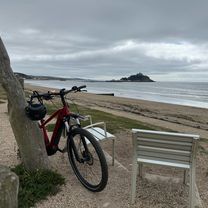
Out of Illogan down to Portreath and along the coast to Godrevy, back via some loops in Tehidy Woods.
- -:--
- Duration
- 38.7 km
- Distance
- 365 m
- Ascent
- 365 m
- Descent
- ---
- Avg. speed
- ---
- Max. altitude

Continue with Bikemap
Use, edit, or download this cycling route
You would like to ride Illogan - Godrevy (Tehidy Woods) or customize it for your own trip? Here is what you can do with this Bikemap route:
Free features
- Save this route as favorite or in collections
- Copy & plan your own version of this route
- Sync your route with Garmin or Wahoo
Premium features
Free trial for 3 days, or one-time payment. More about Bikemap Premium.
- Navigate this route on iOS & Android
- Export a GPX / KML file of this route
- Create your custom printout (try it for free)
- Download this route for offline navigation
Discover more Premium features.
Get Bikemap PremiumFrom our community
Other popular routes starting in Redruth
 Globe Vale Wheel Pervor loop
- Distance
- 2.4 km
- Ascent
- 61 m
- Descent
- 62 m
- Location
- Redruth, England, United Kingdom
 Quick bike tour from Goonlaze to Stithians
- Distance
- 8.8 km
- Ascent
- 57 m
- Descent
- 60 m
- Location
- Redruth, England, United Kingdom
 Lanyon HP to Eden Project
- Distance
- 58.9 km
- Ascent
- 583 m
- Descent
- 682 m
- Location
- Redruth, England, United Kingdom
 Trevithick Road 6, Pool to Trevithick Road 6, Pool
- Distance
- 37 km
- Ascent
- 408 m
- Descent
- 410 m
- Location
- Redruth, England, United Kingdom
 Day 2
Day 2- Distance
- 51.8 km
- Ascent
- 428 m
- Descent
- 407 m
- Location
- Redruth, England, United Kingdom
 Redruth to Penzance via Gwithian and Mousehole
- Distance
- 49.6 km
- Ascent
- 331 m
- Descent
- 444 m
- Location
- Redruth, England, United Kingdom
 Cliff Haven, Sunnyvale Road, Redruth to Speranza, Battery Hill, Redruth
- Distance
- 21.9 km
- Ascent
- 187 m
- Descent
- 189 m
- Location
- Redruth, England, United Kingdom
 Route in Carnhell Green
- Distance
- 24.1 km
- Ascent
- 254 m
- Descent
- 255 m
- Location
- Redruth, England, United Kingdom
Open it in the app