

Aux alentours de Pont de Beauvoisin
A cycling route starting in Le Pont-de-Beauvoisin, Auvergne-Rhône-Alpes, France.
Overview
About this route
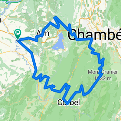
Route passing through: the col du Banchet, the col de la Crusille, the col de Lattaz, the Collet, the col du Mont Tournier, the collet de Botozei, the Collets, ascent of the Pas du Lièvre and tour of Lake Aiguebelette.
- -:--
- Duration
- 87.7 km
- Distance
- 1,748 m
- Ascent
- 1,748 m
- Descent
- ---
- Avg. speed
- ---
- Max. altitude
Route quality
Waytypes & surfaces along the route
Waytypes
Road
36.8 km
(42 %)
Quiet road
24.5 km
(28 %)
Surfaces
Paved
32.4 km
(37 %)
Unpaved
5.3 km
(6 %)
Asphalt
32.4 km
(37 %)
Gravel
2.6 km
(3 %)
Continue with Bikemap
Use, edit, or download this cycling route
You would like to ride Aux alentours de Pont de Beauvoisin or customize it for your own trip? Here is what you can do with this Bikemap route:
Free features
- Save this route as favorite or in collections
- Copy & plan your own version of this route
- Split it into stages to create a multi-day tour
- Sync your route with Garmin or Wahoo
Premium features
Free trial for 3 days, or one-time payment. More about Bikemap Premium.
- Navigate this route on iOS & Android
- Export a GPX / KML file of this route
- Create your custom printout (try it for free)
- Download this route for offline navigation
Discover more Premium features.
Get Bikemap PremiumFrom our community
Other popular routes starting in Le Pont-de-Beauvoisin
 Grand Tour I 2018
- Distance
- 108.9 km
- Ascent
- 2,485 m
- Descent
- 2,485 m
- Location
- Le Pont-de-Beauvoisin, Auvergne-Rhône-Alpes, France
 Recon 2
- Distance
- 34.9 km
- Ascent
- 336 m
- Descent
- 337 m
- Location
- Le Pont-de-Beauvoisin, Auvergne-Rhône-Alpes, France
 warm up loop
- Distance
- 16.4 km
- Ascent
- 399 m
- Descent
- 401 m
- Location
- Le Pont-de-Beauvoisin, Auvergne-Rhône-Alpes, France
 Lac d'Aiguebelette
- Distance
- 82.3 km
- Ascent
- 1,617 m
- Descent
- 1,617 m
- Location
- Le Pont-de-Beauvoisin, Auvergne-Rhône-Alpes, France
 Belmont-Tramonet Recon
- Distance
- 33.9 km
- Ascent
- 438 m
- Descent
- 437 m
- Location
- Le Pont-de-Beauvoisin, Auvergne-Rhône-Alpes, France
 Circuit du Nord-Pays Voironnais
- Distance
- 77.5 km
- Ascent
- 999 m
- Descent
- 991 m
- Location
- Le Pont-de-Beauvoisin, Auvergne-Rhône-Alpes, France
 Lac d'Aiguebelette
- Distance
- 92.5 km
- Ascent
- 1,812 m
- Descent
- 1,812 m
- Location
- Le Pont-de-Beauvoisin, Auvergne-Rhône-Alpes, France
 La Chartreuse 6ème j
- Distance
- 58 km
- Ascent
- 1,245 m
- Descent
- 1,272 m
- Location
- Le Pont-de-Beauvoisin, Auvergne-Rhône-Alpes, France
Open it in the app