S.E.CT 60
A cycling route starting in Old Mystic, Connecticut, United States of America.
Overview
About this route
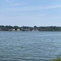
60 miles through 6 towns of Southeast Connecticut. 95% backroads with good visibility.
Plenty of rolling hills, farmland, and classic stonewall-lined New England country roads.
Some fantastic downhills if you like speed. Reverse the direction if you prefer to battle more steep ascents.
Includes many sections that are favorites for local riders.
- -:--
- Duration
- 95.6 km
- Distance
- 553 m
- Ascent
- 559 m
- Descent
- ---
- Avg. speed
- ---
- Avg. speed
Route quality
Waytypes & surfaces along the route
Waytypes
Quiet road
66.6 km
(70 %)
Road
15 km
(16 %)
Surfaces
Paved
19 km
(20 %)
Unpaved
0.5 km
(<1 %)
Paved (undefined)
17.6 km
(18 %)
Asphalt
1.5 km
(2 %)
Continue with Bikemap
Use, edit, or download this cycling route
You would like to ride S.E.CT 60 or customize it for your own trip? Here is what you can do with this Bikemap route:
Free features
- Save this route as favorite or in collections
- Copy & plan your own version of this route
- Sync your route with Garmin or Wahoo
Premium features
Free trial for 3 days, or one-time payment. More about Bikemap Premium.
- Navigate this route on iOS & Android
- Export a GPX / KML file of this route
- Create your custom printout (try it for free)
- Download this route for offline navigation
Discover more Premium features.
Get Bikemap PremiumFrom our community
Other popular routes starting in Old Mystic
- Mystic Stonington 7-31-22
- Distance
- 43.3 km
- Ascent
- 244 m
- Descent
- 240 m
- Location
- Old Mystic, Connecticut, United States of America
- 6 Hendel Dr, Mystic to 6 Hendel Dr, Mystic
- Distance
- 14.4 km
- Ascent
- 6 m
- Descent
- 13 m
- Location
- Old Mystic, Connecticut, United States of America
- 6 Hendel Dr, Mystic to 6 Hendel Dr, Mystic
- Distance
- 14.6 km
- Ascent
- 0 m
- Descent
- 7 m
- Location
- Old Mystic, Connecticut, United States of America
- 6 Hendel Dr, Mystic to 6 Hendel Dr, Mystic
- Distance
- 9.9 km
- Ascent
- 0 m
- Descent
- 7 m
- Location
- Old Mystic, Connecticut, United States of America
- Clara Dr, Mystic to 17 Water St, New London
- Distance
- 3.6 km
- Ascent
- 37 m
- Descent
- 42 m
- Location
- Old Mystic, Connecticut, United States of America
- Mystic, Masons Island
- Distance
- 19.8 km
- Ascent
- 152 m
- Descent
- 152 m
- Location
- Old Mystic, Connecticut, United States of America
- mystic mason island loop
- Distance
- 22.3 km
- Ascent
- 140 m
- Descent
- 139 m
- Location
- Old Mystic, Connecticut, United States of America
- 6 Hendel Dr, Mystic to 6 Hendel Dr, Mystic
- Distance
- 12 km
- Ascent
- 0 m
- Descent
- 6 m
- Location
- Old Mystic, Connecticut, United States of America
Open it in the app