

11.1.1 - Mikow - Duszatyn - Mikow
A cycling route starting in Komańcza, Subcarpathian Voivodeship, Poland.
Overview
About this route
Brody on the Osław, in Duszatyn Bar Dusza Jeziorek
- -:--
- Duration
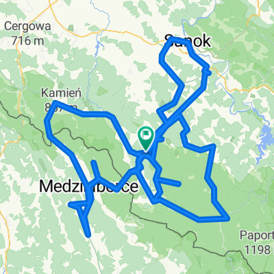
- 8.8 km
- Distance
- 11 m
- Ascent
- 60 m
- Descent
- ---
- Avg. speed
- ---
- Max. altitude

Route quality
Waytypes & surfaces along the route
Waytypes
Quiet road
8.7 km
(99 %)
Access road
0.1 km
(1 %)
Surfaces
Paved
8.8 km
(100 %)
Asphalt
8.5 km
(96 %)
Concrete
0.3 km
(3 %)
Wood
0.1 km
(1 %)
Continue with Bikemap
Use, edit, or download this cycling route
You would like to ride 11.1.1 - Mikow - Duszatyn - Mikow or customize it for your own trip? Here is what you can do with this Bikemap route:
Free features
- Save this route as favorite or in collections
- Copy & plan your own version of this route
- Sync your route with Garmin or Wahoo
Premium features
Free trial for 3 days, or one-time payment. More about Bikemap Premium.
- Navigate this route on iOS & Android
- Export a GPX / KML file of this route
- Create your custom printout (try it for free)
- Download this route for offline navigation
Discover more Premium features.
Get Bikemap PremiumFrom our community
Other popular routes starting in Komańcza
 Rowerowa Wyprawa Bieszczadzka 2-5.08.2013 - dzień 2
- Distance
- 46.8 km
- Ascent
- 1,231 m
- Descent
- 1,117 m
- Location
- Komańcza, Subcarpathian Voivodeship, Poland
 87A, Komańcza do Droga Wojewódzka 897 159
- Distance
- 57.7 km
- Ascent
- 1,414 m
- Descent
- 1,408 m
- Location
- Komańcza, Subcarpathian Voivodeship, Poland
 11.1.1 - Mikow - Duszatyn - Mikow
- Distance
- 8.8 km
- Ascent
- 11 m
- Descent
- 60 m
- Location
- Komańcza, Subcarpathian Voivodeship, Poland
 Wzdłuż granicy Polsko-Słowackiej
- Distance
- 502.3 km
- Ascent
- 1,926 m
- Descent
- 2,056 m
- Location
- Komańcza, Subcarpathian Voivodeship, Poland
 Lyžiarsky pochod Palota-Habura
- Distance
- 19.3 km
- Ascent
- 442 m
- Descent
- 749 m
- Location
- Komańcza, Subcarpathian Voivodeship, Poland
 Łupków -Wołkowyja
- Distance
- 45.7 km
- Ascent
- 351 m
- Descent
- 526 m
- Location
- Komańcza, Subcarpathian Voivodeship, Poland
 Okolice Komańczy
- Distance
- 370.1 km
- Ascent
- 5,593 m
- Descent
- 5,592 m
- Location
- Komańcza, Subcarpathian Voivodeship, Poland
 Nowy Łupków-San-Zamek Sobień-2
- Distance
- 129.5 km
- Ascent
- 1,032 m
- Descent
- 1,274 m
- Location
- Komańcza, Subcarpathian Voivodeship, Poland
Open it in the app