

Motocross-Strecke Puchberg (Militärgelände)
A cycling route starting in Buchkirchen, Upper Austria, Austria.
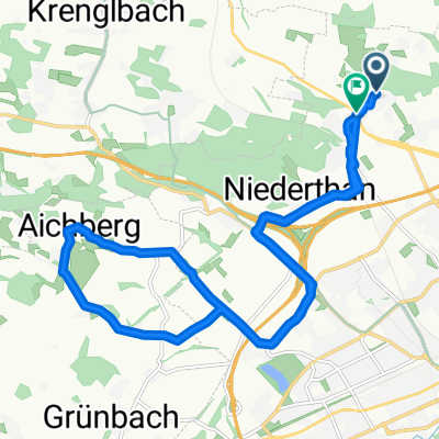
Overview
About this route
-
the route is a training track for motocross riders, so riding on it is actually prohibited
-
also, there is a military training area in between and right next to it (caution!)
-
best to ride on weekdays or weekends, but not Friday afternoon because that's when motocross training takes place
-
almost exclusively dirt/dust/sand surface, partly grassy path, asphalt
-
partly very steep, short climbs; frequent strong ground waves; also bigger jumps
-
with several people, one can, for example, take lap times
- -:--
- Duration
- 4.1 km
- Distance
- 76 m
- Ascent
- 74 m
- Descent
- ---
- Avg. speed
- ---
- Max. altitude
Route highlights
Points of interest along the route
Point of interest after 1.1 km
Startpunkt Motocross-Runde (ev. für Zeitnahme)
Continue with Bikemap
Use, edit, or download this cycling route
You would like to ride Motocross-Strecke Puchberg (Militärgelände) or customize it for your own trip? Here is what you can do with this Bikemap route:
Free features
- Save this route as favorite or in collections
- Copy & plan your own version of this route
- Sync your route with Garmin or Wahoo
Premium features
Free trial for 3 days, or one-time payment. More about Bikemap Premium.
- Navigate this route on iOS & Android
- Export a GPX / KML file of this route
- Create your custom printout (try it for free)
- Download this route for offline navigation
Discover more Premium features.
Get Bikemap PremiumFrom our community
Other popular routes starting in Buchkirchen
 Puchberg-Fernreith-Puchberg
- Distance
- 17.8 km
- Ascent
- 104 m
- Descent
- 114 m
- Location
- Buchkirchen, Upper Austria, Austria
 Katzbach-Scharten-Eferding-Stroheim
- Distance
- 54.2 km
- Ascent
- 677 m
- Descent
- 701 m
- Location
- Buchkirchen, Upper Austria, Austria
 Test 8km
- Distance
- 8 km
- Ascent
- 67 m
- Descent
- 67 m
- Location
- Buchkirchen, Upper Austria, Austria
 Sonnleiten - Fernreith
- Distance
- 17.2 km
- Ascent
- 129 m
- Descent
- 128 m
- Location
- Buchkirchen, Upper Austria, Austria
 Flache Traunroute bis nach Traun
- Distance
- 52.3 km
- Ascent
- 146 m
- Descent
- 146 m
- Location
- Buchkirchen, Upper Austria, Austria
 Marchtrenker Straße 26, Oberhocherenz nach Oberhocherenz 24
- Distance
- 32.7 km
- Ascent
- 269 m
- Descent
- 262 m
- Location
- Buchkirchen, Upper Austria, Austria
 Grieskirchen auf a EIS
- Distance
- 44.6 km
- Ascent
- 287 m
- Descent
- 284 m
- Location
- Buchkirchen, Upper Austria, Austria
 Hoch und Runter am Sonntag Vormittag
- Distance
- 17.2 km
- Ascent
- 175 m
- Descent
- 177 m
- Location
- Buchkirchen, Upper Austria, Austria
Open it in the app