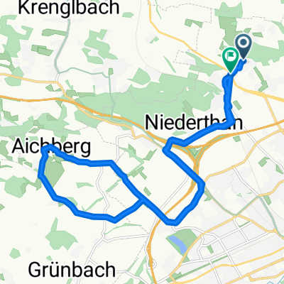
Flache Traunroute bis (kurz vor) Schwanenstadt
A cycling route starting in Buchkirchen, Upper Austria, Austria.
Overview
About this route
-
fast immer Asphalt-Straße/-Weg, nur ganz kurzes Stück (etwa 500 Meter) Schotter
-
hauptsächlich flach, einige kleine, einige größere Anstiege und auch Abfahrten
-
meist Radweg oder wenig befahrene Straßen
-
sehr schöne Umgebung, häufig Wald neben der Straße
- -:--
- Duration
- 59.4 km
- Distance
- 201 m
- Ascent
- 200 m
- Descent
- ---
- Avg. speed
- ---
- Avg. speed
Route quality
Waytypes & surfaces along the route
Waytypes
Quiet road
34.6 km
(58 %)
Busy road
14.1 km
(24 %)
Surfaces
Paved
23 km
(39 %)
Unpaved
0.8 km
(1 %)
Asphalt
22.8 km
(38 %)
Gravel
0.8 km
(1 %)
Continue with Bikemap
Use, edit, or download this cycling route
You would like to ride Flache Traunroute bis (kurz vor) Schwanenstadt or customize it for your own trip? Here is what you can do with this Bikemap route:
Free features
- Save this route as favorite or in collections
- Copy & plan your own version of this route
- Sync your route with Garmin or Wahoo
Premium features
Free trial for 3 days, or one-time payment. More about Bikemap Premium.
- Navigate this route on iOS & Android
- Export a GPX / KML file of this route
- Create your custom printout (try it for free)
- Download this route for offline navigation
Discover more Premium features.
Get Bikemap PremiumFrom our community
Other popular routes starting in Buchkirchen
- Flache Traunroute bis (kurz vor) Schwanenstadt
- Distance
- 59.4 km
- Ascent
- 201 m
- Descent
- 200 m
- Location
- Buchkirchen, Upper Austria, Austria
- Marchtrenker Straße 26, Oberhocherenz nach Oberhocherenz 24
- Distance
- 32.7 km
- Ascent
- 269 m
- Descent
- 262 m
- Location
- Buchkirchen, Upper Austria, Austria
- Flache Traunroute bis nach Traun
- Distance
- 52.3 km
- Ascent
- 146 m
- Descent
- 146 m
- Location
- Buchkirchen, Upper Austria, Austria
- Katzbach-Scharten-Eferding-Stroheim
- Distance
- 54.2 km
- Ascent
- 677 m
- Descent
- 701 m
- Location
- Buchkirchen, Upper Austria, Austria
- Hoch und Runter am Sonntag Vormittag
- Distance
- 17.2 km
- Ascent
- 175 m
- Descent
- 177 m
- Location
- Buchkirchen, Upper Austria, Austria
- Motocross-Strecke Puchberg (Militärgelände)
- Distance
- 4.1 km
- Ascent
- 76 m
- Descent
- 74 m
- Location
- Buchkirchen, Upper Austria, Austria
- Scharten
- Distance
- 17.9 km
- Ascent
- 466 m
- Descent
- 424 m
- Location
- Buchkirchen, Upper Austria, Austria
- Test 8km
- Distance
- 8 km
- Ascent
- 67 m
- Descent
- 67 m
- Location
- Buchkirchen, Upper Austria, Austria
Open it in the app