
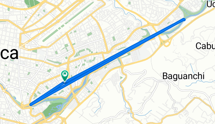
De Medardo A. Silva 27, Cuenca a Medardo A. Silva 1-17, Cuenca
A cycling route starting in Cuenca, Azuay, Ecuador.
Overview
About this route
- 1 h 9 min
- Duration
- 9.8 km
- Distance
- 22 m
- Ascent
- 28 m
- Descent
- 8.5 km/h
- Avg. speed
- ---
- Max. altitude

Route photos


Route quality
Waytypes & surfaces along the route
Waytypes
Cycleway
7.6 km
(78 %)
Quiet road
1.6 km
(16 %)
Surfaces
Paved
3.8 km
(39 %)
Unpaved
0.1 km
(1 %)
Asphalt
3 km
(31 %)
Paved (undefined)
0.7 km
(7 %)
Continue with Bikemap
Use, edit, or download this cycling route
You would like to ride De Medardo A. Silva 27, Cuenca a Medardo A. Silva 1-17, Cuenca or customize it for your own trip? Here is what you can do with this Bikemap route:
Free features
- Save this route as favorite or in collections
- Copy & plan your own version of this route
- Sync your route with Garmin or Wahoo
Premium features
Free trial for 3 days, or one-time payment. More about Bikemap Premium.
- Navigate this route on iOS & Android
- Export a GPX / KML file of this route
- Create your custom printout (try it for free)
- Download this route for offline navigation
Discover more Premium features.
Get Bikemap PremiumFrom our community
Other popular routes starting in Cuenca
 De 4W3W+P4H, Cuenca a 4W3W+P4H, Cuenca
- Distance
- 54 km
- Ascent
- 652 m
- Descent
- 752 m
- Location
- Cuenca, Azuay, Ecuador
 De Medardo A. Silva 27, Cuenca a Medardo A. Silva 1-17, Cuenca
- Distance
- 9.8 km
- Ascent
- 22 m
- Descent
- 28 m
- Location
- Cuenca, Azuay, Ecuador
 De De La Passiflora, Cuenca a Cruces de Barabón, Cuenca
- Distance
- 17.5 km
- Ascent
- 719 m
- Descent
- 712 m
- Location
- Cuenca, Azuay, Ecuador
 Loop Cuenca Narancay Banos Cuenca
- Distance
- 32.5 km
- Ascent
- 773 m
- Descent
- 773 m
- Location
- Cuenca, Azuay, Ecuador
 De 5XPX+J4C, Chiquintad a Parque Central de Chiquintad
- Distance
- 52.8 km
- Ascent
- 5,997 m
- Descent
- 5,993 m
- Location
- Cuenca, Azuay, Ecuador
 De Saraurco 106, Cuenca a Saraurco 106, Cuenca
- Distance
- 29 km
- Ascent
- 1,214 m
- Descent
- 1,214 m
- Location
- Cuenca, Azuay, Ecuador
 Cuenca - Quito
- Distance
- 433.3 km
- Ascent
- 4,798 m
- Descent
- 4,498 m
- Location
- Cuenca, Azuay, Ecuador
 Cuenca to Barabon CLONED FROM ROUTE 880595
- Distance
- 14.5 km
- Ascent
- 1,039 m
- Descent
- 23 m
- Location
- Cuenca, Azuay, Ecuador
Open it in the app