

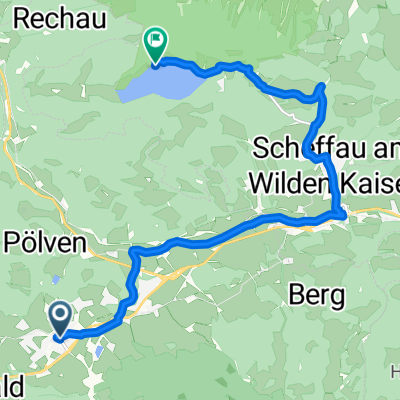
Söll - Rübezahlalm
A cycling route starting in Söll, Tyrol, Austria.
Overview
About this route
- -:--
- Duration
- 13.2 km
- Distance
- 567 m
- Ascent
- 92 m
- Descent
- ---
- Avg. speed
- ---
- Max. altitude

Continue with Bikemap
Use, edit, or download this cycling route
You would like to ride Söll - Rübezahlalm or customize it for your own trip? Here is what you can do with this Bikemap route:
Free features
- Save this route as favorite or in collections
- Copy & plan your own version of this route
- Sync your route with Garmin or Wahoo
Premium features
Free trial for 3 days, or one-time payment. More about Bikemap Premium.
- Navigate this route on iOS & Android
- Export a GPX / KML file of this route
- Create your custom printout (try it for free)
- Download this route for offline navigation
Discover more Premium features.
Get Bikemap PremiumFrom our community
Other popular routes starting in Söll
 Hohe Salve
- Distance
- 9.6 km
- Ascent
- 1,116 m
- Descent
- 37 m
- Location
- Söll, Tyrol, Austria
 Dorf to Unterwindau
- Distance
- 15.7 km
- Ascent
- 376 m
- Descent
- 377 m
- Location
- Söll, Tyrol, Austria
 Part of Soll - Hexenwasser
- Distance
- 2.5 km
- Ascent
- 377 m
- Descent
- 50 m
- Location
- Söll, Tyrol, Austria
 Söll Bergdoktor Haus
- Distance
- 5.5 km
- Ascent
- 405 m
- Descent
- 93 m
- Location
- Söll, Tyrol, Austria
 Soell - Hintersteinersee 22km 600 hm
- Distance
- 21.5 km
- Ascent
- 652 m
- Descent
- 652 m
- Location
- Söll, Tyrol, Austria
 Söll Hintersteiner
- Distance
- 38.3 km
- Ascent
- 795 m
- Descent
- 799 m
- Location
- Söll, Tyrol, Austria
 Zum Hintersteiner See
- Distance
- 12.1 km
- Ascent
- 332 m
- Descent
- 133 m
- Location
- Söll, Tyrol, Austria
 Söll - Hartkaiser - Brandstadl - Hochsöll - Söll
- Distance
- 33.4 km
- Ascent
- 1,026 m
- Descent
- 1,026 m
- Location
- Söll, Tyrol, Austria
Open it in the app