

Gemenci-erdő körbetekerése, avagy a Két híd túrája
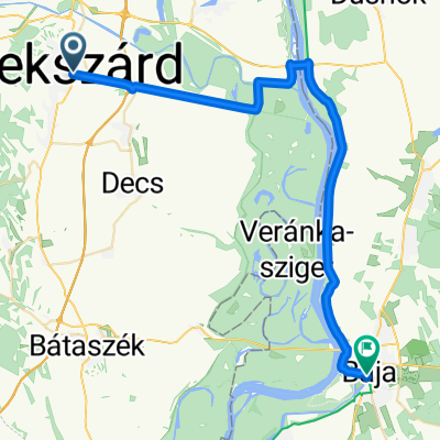
A cycling route starting in Szekszárd, Tolna County, Hungary.
Overview
About this route
- -:--
- Duration
- 80.9 km
- Distance
- 91 m
- Ascent
- 91 m
- Descent
- ---
- Avg. speed
- ---
- Max. altitude

Route quality
Waytypes & surfaces along the route
Waytypes
Access road
25.1 km
(31 %)
Quiet road
17 km
(21 %)
Surfaces
Paved
66.3 km
(82 %)
Unpaved
8.9 km
(11 %)
Asphalt
63.9 km
(79 %)
Ground
8.1 km
(10 %)
Continue with Bikemap
Use, edit, or download this cycling route
You would like to ride Gemenci-erdő körbetekerése, avagy a Két híd túrája or customize it for your own trip? Here is what you can do with this Bikemap route:
Free features
- Save this route as favorite or in collections
- Copy & plan your own version of this route
- Split it into stages to create a multi-day tour
- Sync your route with Garmin or Wahoo
Premium features
Free trial for 3 days, or one-time payment. More about Bikemap Premium.
- Navigate this route on iOS & Android
- Export a GPX / KML file of this route
- Create your custom printout (try it for free)
- Download this route for offline navigation
Discover more Premium features.
Get Bikemap PremiumFrom our community
Other popular routes starting in Szekszárd
 Szekszárd-Szálka erdőn át
- Distance
- 12.8 km
- Ascent
- 225 m
- Descent
- 128 m
- Location
- Szekszárd, Tolna County, Hungary
 Bartina 15
- Distance
- 15.7 km
- Ascent
- 451 m
- Descent
- 429 m
- Location
- Szekszárd, Tolna County, Hungary
 "8"-as túra
- Distance
- 34.9 km
- Ascent
- 368 m
- Descent
- 368 m
- Location
- Szekszárd, Tolna County, Hungary
 Szekszárd-Alsónyék-Szekszárd
- Distance
- 46.9 km
- Ascent
- 131 m
- Descent
- 128 m
- Location
- Szekszárd, Tolna County, Hungary
 Szekszárd-Sükösd-Nemesnádudvar
- Distance
- 48.5 km
- Ascent
- 102 m
- Descent
- 107 m
- Location
- Szekszárd, Tolna County, Hungary
 Gemenci-erdő körbetekerése, avagy a Két híd túrája
- Distance
- 80.9 km
- Ascent
- 91 m
- Descent
- 91 m
- Location
- Szekszárd, Tolna County, Hungary
 0. nap
- Distance
- 13.1 km
- Ascent
- 158 m
- Descent
- 105 m
- Location
- Szekszárd, Tolna County, Hungary
 From Szekszárd to Baja
- Distance
- 41.3 km
- Ascent
- 85 m
- Descent
- 91 m
- Location
- Szekszárd, Tolna County, Hungary
Open it in the app