

De Peireguis 38, Le Val à Peireguis 38, Le Val
A cycling route starting in Le Val, Provence-Alpes-Côte d'Azur Region, France.
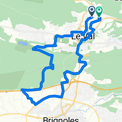
Overview
About this route
- 1 h 48 min
- Duration
- 25.3 km
- Distance
- 490 m
- Ascent
- 439 m
- Descent
- 14 km/h
- Avg. speed
- ---
- Max. altitude

Continue with Bikemap
Use, edit, or download this cycling route
You would like to ride De Peireguis 38, Le Val à Peireguis 38, Le Val or customize it for your own trip? Here is what you can do with this Bikemap route:
Free features
- Save this route as favorite or in collections
- Copy & plan your own version of this route
- Sync your route with Garmin or Wahoo
Premium features
Free trial for 3 days, or one-time payment. More about Bikemap Premium.
- Navigate this route on iOS & Android
- Export a GPX / KML file of this route
- Create your custom printout (try it for free)
- Download this route for offline navigation
Discover more Premium features.
Get Bikemap PremiumFrom our community
Other popular routes starting in Le Val
 De Chemin des Rebias à Chemin des Rebias
- Distance
- 16.1 km
- Ascent
- 224 m
- Descent
- 225 m
- Location
- Le Val, Provence-Alpes-Côte d'Azur Region, France
 64 MON
- Distance
- 64.5 km
- Ascent
- 544 m
- Descent
- 544 m
- Location
- Le Val, Provence-Alpes-Côte d'Azur Region, France
 Le Val - Bras - Barjols - Le Val
- Distance
- 47.4 km
- Ascent
- 789 m
- Descent
- 794 m
- Location
- Le Val, Provence-Alpes-Côte d'Azur Region, France
 Allauch 2017 Nizza-LeVal
- Distance
- 131.2 km
- Ascent
- 1,012 m
- Descent
- 1,258 m
- Location
- Le Val, Provence-Alpes-Côte d'Azur Region, France
 Allauch22 Tag 12 Sa 11.6.
- Distance
- 74.1 km
- Ascent
- 1,034 m
- Descent
- 978 m
- Location
- Le Val, Provence-Alpes-Côte d'Azur Region, France
 De Chemin des Rebias à Chemin des Rebias
- Distance
- 16.1 km
- Ascent
- 224 m
- Descent
- 225 m
- Location
- Le Val, Provence-Alpes-Côte d'Azur Region, France
 De Peireguis 9, Le Val à Peireguis 38, Le Val
- Distance
- 28.9 km
- Ascent
- 595 m
- Descent
- 589 m
- Location
- Le Val, Provence-Alpes-Côte d'Azur Region, France
 Le Val - Colle du Monjoun - Le Val
- Distance
- 30.7 km
- Ascent
- 422 m
- Descent
- 425 m
- Location
- Le Val, Provence-Alpes-Côte d'Azur Region, France
Open it in the app