

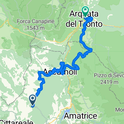
TAPPA 9 CIVITA- L'AQUILA KM 66
A cycling route starting in Cittareale, Latium, Italy.
Overview
About this route
- -:--
- Duration
- 66.2 km
- Distance
- 463 m
- Ascent
- 911 m
- Descent
- ---
- Avg. speed
- ---
- Max. altitude

Route quality
Waytypes & surfaces along the route
Waytypes
Road
32.4 km
(49 %)
Busy road
15.5 km
(23 %)
Surfaces
Paved
27.1 km
(41 %)
Asphalt
27.1 km
(41 %)
Undefined
39.1 km
(59 %)
Continue with Bikemap
Use, edit, or download this cycling route
You would like to ride TAPPA 9 CIVITA- L'AQUILA KM 66 or customize it for your own trip? Here is what you can do with this Bikemap route:
Free features
- Save this route as favorite or in collections
- Copy & plan your own version of this route
- Sync your route with Garmin or Wahoo
Premium features
Free trial for 3 days, or one-time payment. More about Bikemap Premium.
- Navigate this route on iOS & Android
- Export a GPX / KML file of this route
- Create your custom printout (try it for free)
- Download this route for offline navigation
Discover more Premium features.
Get Bikemap PremiumFrom our community
Other popular routes starting in Cittareale
 gndghmn
- Distance
- 159.3 km
- Ascent
- 1,792 m
- Descent
- 2,293 m
- Location
- Cittareale, Latium, Italy
 Da Località Cascine di Opagna, Civita a Via Di Villa Lucci 22-30, Villa Massi
- Distance
- 29.6 km
- Ascent
- 1,000 m
- Descent
- 1,266 m
- Location
- Cittareale, Latium, Italy
 ABT Tappa 16: Arquata del Tronto - Amatrice
- Distance
- 41.5 km
- Ascent
- 1,892 m
- Descent
- 2,414 m
- Location
- Cittareale, Latium, Italy
 Italy2020 E18b
- Distance
- 60.1 km
- Ascent
- 1,054 m
- Descent
- 955 m
- Location
- Cittareale, Latium, Italy
 TAPPA 9 CIVITA- L'AQUILA KM 66
- Distance
- 66.2 km
- Ascent
- 463 m
- Descent
- 911 m
- Location
- Cittareale, Latium, Italy
 Cittareale
- Distance
- 11.4 km
- Ascent
- 743 m
- Descent
- 83 m
- Location
- Cittareale, Latium, Italy
Open it in the app