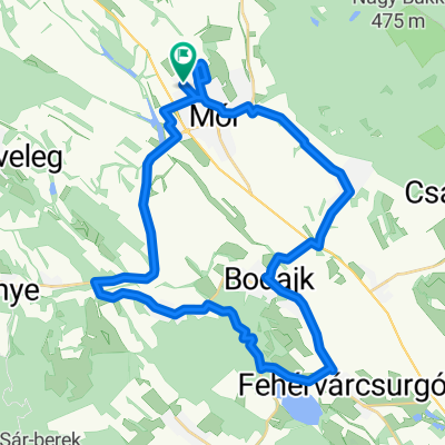
randonne 300
A cycling route starting in Mór, Fejér, Hungary.
Overview
About this route
A BRM (Brevets de Randonneurs Mondiaux) a aris-Brest-Paris (PBP) teljesÃtménytúrához kvalifikációs teljesÃtménytúra-sorozat.
- -:--
- Duration
- 302.2 km
- Distance
- 792 m
- Ascent
- 792 m
- Descent
- ---
- Avg. speed
- ---
- Max. altitude
Route quality
Waytypes & surfaces along the route
Waytypes
Busy road
187.1 km
(62 %)
Quiet road
43.1 km
(14 %)
Surfaces
Paved
189.2 km
(63 %)
Unpaved
13 km
(4 %)
Asphalt
170.8 km
(57 %)
Paved (undefined)
15.9 km
(5 %)
Continue with Bikemap
Use, edit, or download this cycling route
You would like to ride randonne 300 or customize it for your own trip? Here is what you can do with this Bikemap route:
Free features
- Save this route as favorite or in collections
- Copy & plan your own version of this route
- Split it into stages to create a multi-day tour
- Sync your route with Garmin or Wahoo
Premium features
Free trial for 3 days, or one-time payment. More about Bikemap Premium.
- Navigate this route on iOS & Android
- Export a GPX / KML file of this route
- Create your custom printout (try it for free)
- Download this route for offline navigation
Discover more Premium features.
Get Bikemap PremiumFrom our community
Other popular routes starting in Mór
- randonne 300
- Distance
- 302.2 km
- Ascent
- 792 m
- Descent
- 792 m
- Location
- Mór, Fejér, Hungary
- Móri karika 25 km
- Distance
- 26.3 km
- Ascent
- 202 m
- Descent
- 201 m
- Location
- Mór, Fejér, Hungary
- 2016-04-03
- Distance
- 35.5 km
- Ascent
- 372 m
- Descent
- 370 m
- Location
- Mór, Fejér, Hungary
- Székesfehérvár Mór, 81-es nélkül
- Distance
- 30.1 km
- Ascent
- 71 m
- Descent
- 144 m
- Location
- Mór, Fejér, Hungary
- Csókakör
- Distance
- 29.5 km
- Ascent
- 413 m
- Descent
- 414 m
- Location
- Mór, Fejér, Hungary
- Mór-Tihany-Balatonfüred
- Distance
- 102.1 km
- Ascent
- 323 m
- Descent
- 396 m
- Location
- Mór, Fejér, Hungary
- Mór-Csókakő-Mór
- Distance
- 33.2 km
- Ascent
- 354 m
- Descent
- 350 m
- Location
- Mór, Fejér, Hungary
- Mór-Nagyveleg-Bakonycsernye-Mór
- Distance
- 25.6 km
- Ascent
- 290 m
- Descent
- 290 m
- Location
- Mór, Fejér, Hungary
Open it in the app