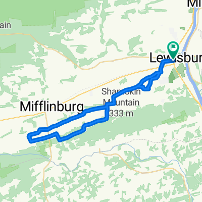
South of Rt 45 Lewisburg to Penns creek Loop
A cycling route starting in Linntown, Pennsylvania, United States of America.
Overview
About this route
- -:--
- Duration
- 40.8 km
- Distance
- 196 m
- Ascent
- 198 m
- Descent
- ---
- Avg. speed
- ---
- Avg. speed
Route quality
Waytypes & surfaces along the route
Waytypes
Quiet road
20.4 km
(50 %)
Road
9.7 km
(24 %)
Surfaces
Paved
17.8 km
(44 %)
Unpaved
7.2 km
(18 %)
Asphalt
13.1 km
(32 %)
Gravel
7.2 km
(18 %)
Continue with Bikemap
Use, edit, or download this cycling route
You would like to ride South of Rt 45 Lewisburg to Penns creek Loop or customize it for your own trip? Here is what you can do with this Bikemap route:
Free features
- Save this route as favorite or in collections
- Copy & plan your own version of this route
- Sync your route with Garmin or Wahoo
Premium features
Free trial for 3 days, or one-time payment. More about Bikemap Premium.
- Navigate this route on iOS & Android
- Export a GPX / KML file of this route
- Create your custom printout (try it for free)
- Download this route for offline navigation
Discover more Premium features.
Get Bikemap PremiumFrom our community
Other popular routes starting in Linntown
- 25 miles from Earls Bicycle Store (Southwest)
- Distance
- 41.4 km
- Ascent
- 260 m
- Descent
- 260 m
- Location
- Linntown, Pennsylvania, United States of America
- 64 miles from Bucknell
- Distance
- 102.9 km
- Ascent
- 261 m
- Descent
- 261 m
- Location
- Linntown, Pennsylvania, United States of America
- 30 miles from Earls Bicycle Store (West)
- Distance
- 48 km
- Ascent
- 276 m
- Descent
- 277 m
- Location
- Linntown, Pennsylvania, United States of America
- New Berlin Mountain
- Distance
- 30.8 km
- Ascent
- 335 m
- Descent
- 345 m
- Location
- Linntown, Pennsylvania, United States of America
- Lewisburg / White Deer Loop
- Distance
- 39.9 km
- Ascent
- 381 m
- Descent
- 377 m
- Location
- Linntown, Pennsylvania, United States of America
- 104 miles of Montour, Snyder and Union Cos
- Distance
- 167.3 km
- Ascent
- 1,240 m
- Descent
- 1,201 m
- Location
- Linntown, Pennsylvania, United States of America
- Jacks Mountian Loop
- Distance
- 78.9 km
- Ascent
- 687 m
- Descent
- 687 m
- Location
- Linntown, Pennsylvania, United States of America
- Try All by Fire1 - road bike
- Distance
- 79.7 km
- Ascent
- 598 m
- Descent
- 555 m
- Location
- Linntown, Pennsylvania, United States of America
Open it in the app