

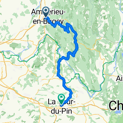
Ambérieu - Ambérieu
A cycling route starting in Ambérieu-en-Bugey, Auvergne-Rhône-Alpes, France.
Overview
About this route
Col de Portes, Col du Ballon, Montgriffon
- -:--
- Duration
- 115.3 km
- Distance
- 2,046 m
- Ascent
- 2,047 m
- Descent
- ---
- Avg. speed
- ---
- Max. altitude
Route quality
Waytypes & surfaces along the route
Waytypes
Road
59.1 km
(51 %)
Busy road
28.3 km
(25 %)
Surfaces
Paved
22.2 km
(19 %)
Asphalt
22 km
(19 %)
Concrete
0.2 km
(<1 %)
Undefined
93.1 km
(81 %)
Continue with Bikemap
Use, edit, or download this cycling route
You would like to ride Ambérieu - Ambérieu or customize it for your own trip? Here is what you can do with this Bikemap route:
Free features
- Save this route as favorite or in collections
- Copy & plan your own version of this route
- Split it into stages to create a multi-day tour
- Sync your route with Garmin or Wahoo
Premium features
Free trial for 3 days, or one-time payment. More about Bikemap Premium.
- Navigate this route on iOS & Android
- Export a GPX / KML file of this route
- Create your custom printout (try it for free)
- Download this route for offline navigation
Discover more Premium features.
Get Bikemap PremiumFrom our community
Other popular routes starting in Ambérieu-en-Bugey
 Amberieu - La Tour du Pin
- Distance
- 91.3 km
- Ascent
- 1,280 m
- Descent
- 1,105 m
- Location
- Ambérieu-en-Bugey, Auvergne-Rhône-Alpes, France
 Ambérieu - Culoz
- Distance
- 94.7 km
- Ascent
- 2,163 m
- Descent
- 2,171 m
- Location
- Ambérieu-en-Bugey, Auvergne-Rhône-Alpes, France
 acsp-cyt flèche vélocio 04 et 05 avril 2015
- Distance
- 390.1 km
- Ascent
- 2,391 m
- Descent
- 2,067 m
- Location
- Ambérieu-en-Bugey, Auvergne-Rhône-Alpes, France
 Entlang dem Ain: Zusatz nach Genf-Cointrin
- Distance
- 128.7 km
- Ascent
- 2,240 m
- Descent
- 2,063 m
- Location
- Ambérieu-en-Bugey, Auvergne-Rhône-Alpes, France
 Amberieu en Bugey - Tarare
- Distance
- 172.1 km
- Ascent
- 1,116 m
- Descent
- 977 m
- Location
- Ambérieu-en-Bugey, Auvergne-Rhône-Alpes, France
 Ambérieu en Bugey, circuit 57 km
- Distance
- 57.2 km
- Ascent
- 1,162 m
- Descent
- 1,163 m
- Location
- Ambérieu-en-Bugey, Auvergne-Rhône-Alpes, France
 Ambérieu - Ambérieu
- Distance
- 115.3 km
- Ascent
- 2,046 m
- Descent
- 2,047 m
- Location
- Ambérieu-en-Bugey, Auvergne-Rhône-Alpes, France
 b8 Traversée du Bugey
- Distance
- 89.5 km
- Ascent
- 1,791 m
- Descent
- 1,759 m
- Location
- Ambérieu-en-Bugey, Auvergne-Rhône-Alpes, France
Open it in the app