
Faire du vélo entre la côte et le parc naturel
A cycling route starting in La Baule-Escoublac, Pays de la Loire Region, France.
Overview
About this route
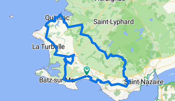
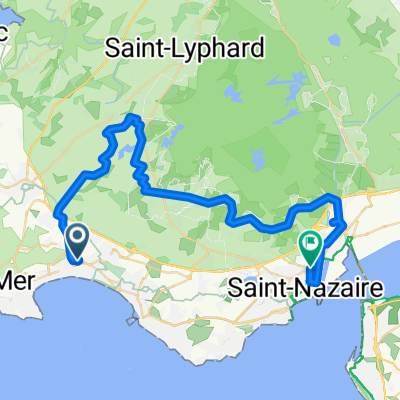
This 80 km road cycling route starts and ends at the La Baule-Escoublac train station. The first part of the itinerary passes through the Brière regional natural park. The return takes place along the coast and the salt marshes of Guérande, a vast salt extraction area. Along the way, you can enjoy the beautiful nature and the comfort of small Breton villages.
- 5 h 7 min
- Duration
- 81.1 km
- Distance
- 296 m
- Ascent
- 294 m
- Descent
- 15.8 km/h
- Avg. speed
- ---
- Max. altitude

Route quality
Waytypes & surfaces along the route
Waytypes
Quiet road
43 km
(53 %)
Road
26 km
(32 %)
Surfaces
Paved
54.4 km
(67 %)
Unpaved
0.8 km
(1 %)
Asphalt
53.5 km
(66 %)
Concrete
0.8 km
(1 %)
Continue with Bikemap
Use, edit, or download this cycling route
You would like to ride Faire du vélo entre la côte et le parc naturel or customize it for your own trip? Here is what you can do with this Bikemap route:
Free features
- Save this route as favorite or in collections
- Copy & plan your own version of this route
- Split it into stages to create a multi-day tour
- Sync your route with Garmin or Wahoo
Premium features
Free trial for 3 days, or one-time payment. More about Bikemap Premium.
- Navigate this route on iOS & Android
- Export a GPX / KML file of this route
- Create your custom printout (try it for free)
- Download this route for offline navigation
Discover more Premium features.
Get Bikemap PremiumFrom our community
Other popular routes starting in La Baule-Escoublac
 14 Boulevard Joseph Houssais, La Baule-Escoublac à 16 Boulevard Joseph Houssais, La Baule-Escoublac
- Distance
- 56 km
- Ascent
- 1,236 m
- Descent
- 1,234 m
- Location
- La Baule-Escoublac, Pays de la Loire Region, France
 7 Allée des Petits Brivins, La Baule nach Rue des Parcs, Le Croisic
- Distance
- 13.1 km
- Ascent
- 26 m
- Descent
- 31 m
- Location
- La Baule-Escoublac, Pays de la Loire Region, France
 La Baule-Trignac-la chapelle des Marais
- Distance
- 68.6 km
- Ascent
- 147 m
- Descent
- 147 m
- Location
- La Baule-Escoublac, Pays de la Loire Region, France
 7 Route de Ker Rivaud, La Baule à 6 Place du Marche au Bois, Guérande
- Distance
- 7.3 km
- Ascent
- 55 m
- Descent
- 53 m
- Location
- La Baule-Escoublac, Pays de la Loire Region, France
 Faire du vélo entre la côte et le parc naturel
- Distance
- 81.1 km
- Ascent
- 296 m
- Descent
- 294 m
- Location
- La Baule-Escoublac, Pays de la Loire Region, France
 patrimoinestnaz
- Distance
- 41.1 km
- Ascent
- 76 m
- Descent
- 73 m
- Location
- La Baule-Escoublac, Pays de la Loire Region, France
 mesquer/la baule
- Distance
- 17.2 km
- Ascent
- 96 m
- Descent
- 98 m
- Location
- La Baule-Escoublac, Pays de la Loire Region, France
 4ª etapa
- Distance
- 203.9 km
- Ascent
- 478 m
- Descent
- 455 m
- Location
- La Baule-Escoublac, Pays de la Loire Region, France
Open it in the app