Bassenge en terug
- 53.7 km
- 360 m
- 372 m
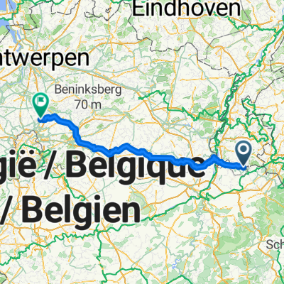
- Sint-Pieters-Voeren, Flemish Region, Belgium
A cycling route starting in Sint-Pieters-Voeren, Flemish Region, Belgium.
Overview
Highlights: Eijsden ferry, Kanne, Eben-Emael, Walloon Jeker valley-Visé and Voeren
created this 4 years ago
Route quality
Quiet road
19.7 km
(43 %)
Cycleway
11 km
(24 %)
Paved
28.9 km
(63 %)
Unpaved
0.5 km
(1 %)
Asphalt
16.1 km
(35 %)
Concrete
9.6 km
(21 %)
Continue with Bikemap
You would like to ride Voeren-eijsden-Kanne-Jekervallai-Eben Emaël-via Hallembaye en Visé terug or customize it for your own trip? Here is what you can do with this Bikemap route:
Free trial for 3 days, or one-time payment. More about Bikemap Premium.
Discover more Premium features.
Get Bikemap PremiumFrom our community
Open it in the app