

Rhaner Zell 18, Schönthal nach Rhaner Zell 18, Schönthal
A cycling route starting in Schönthal, Bavaria, Germany.
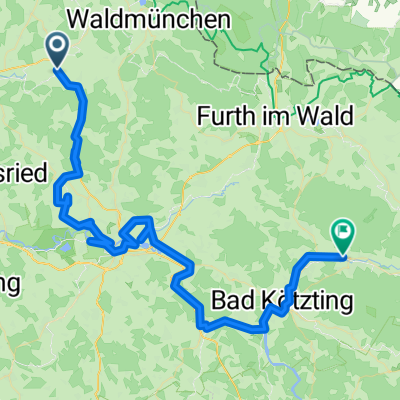
Overview
About this route
- 4 h 35 min
- Duration
- 24 km
- Distance
- 341 m
- Ascent
- 341 m
- Descent
- 5.2 km/h
- Avg. speed
- ---
- Max. altitude
Continue with Bikemap
Use, edit, or download this cycling route
You would like to ride Rhaner Zell 18, Schönthal nach Rhaner Zell 18, Schönthal or customize it for your own trip? Here is what you can do with this Bikemap route:
Free features
- Save this route as favorite or in collections
- Copy & plan your own version of this route
- Sync your route with Garmin or Wahoo
Premium features
Free trial for 3 days, or one-time payment. More about Bikemap Premium.
- Navigate this route on iOS & Android
- Export a GPX / KML file of this route
- Create your custom printout (try it for free)
- Download this route for offline navigation
Discover more Premium features.
Get Bikemap PremiumFrom our community
Other popular routes starting in Schönthal
 Recovered Route
- Distance
- 9.4 km
- Ascent
- 157 m
- Descent
- 36 m
- Location
- Schönthal, Bavaria, Germany
 Trans Bayerwald Südroute Etappe 1
- Distance
- 39 km
- Ascent
- 1,075 m
- Descent
- 1,129 m
- Location
- Schönthal, Bavaria, Germany
 Moderate Route in Schönthal
- Distance
- 0.1 km
- Ascent
- 4 m
- Descent
- 0 m
- Location
- Schönthal, Bavaria, Germany
 Silberseerunde
- Distance
- 22.8 km
- Ascent
- 106 m
- Descent
- 106 m
- Location
- Schönthal, Bavaria, Germany
 Eixendorfer see
- Distance
- 41 km
- Ascent
- 227 m
- Descent
- 224 m
- Location
- Schönthal, Bavaria, Germany
 Route nach Thurau 10, Schönthal
- Distance
- 10.5 km
- Ascent
- 68 m
- Descent
- 65 m
- Location
- Schönthal, Bavaria, Germany
 Hauptstraße 16, Schönthal nach Friedrichshäng 8, Schönsee
- Distance
- 28.2 km
- Ascent
- 612 m
- Descent
- 326 m
- Location
- Schönthal, Bavaria, Germany
 Schönthal - Hohenwarth
- Distance
- 69.6 km
- Ascent
- 720 m
- Descent
- 727 m
- Location
- Schönthal, Bavaria, Germany
Open it in the app