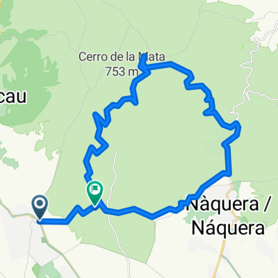
tristan y alrededores
A cycling route starting in Olocau, Valencia, Spain.
Overview
About this route
Route with significant elevation change through little-known corners of the Calderona, passing by several very interesting ruined buildings.
- -:--
- Duration
- 29 km
- Distance
- 864 m
- Ascent
- 867 m
- Descent
- ---
- Avg. speed
- ---
- Max. altitude
Route quality
Waytypes & surfaces along the route
Waytypes
Track
26.7 km
(92 %)
Path
1.5 km
(5 %)
Surfaces
Paved
1.2 km
(4 %)
Unpaved
25.6 km
(88 %)
Unpaved (undefined)
14.5 km
(50 %)
Gravel
11 km
(38 %)
Continue with Bikemap
Use, edit, or download this cycling route
You would like to ride tristan y alrededores or customize it for your own trip? Here is what you can do with this Bikemap route:
Free features
- Save this route as favorite or in collections
- Copy & plan your own version of this route
- Sync your route with Garmin or Wahoo
Premium features
Free trial for 3 days, or one-time payment. More about Bikemap Premium.
- Navigate this route on iOS & Android
- Export a GPX / KML file of this route
- Create your custom printout (try it for free)
- Download this route for offline navigation
Discover more Premium features.
Get Bikemap PremiumFrom our community
Other popular routes starting in Olocau
 La Trialera de Tristán IBP61
- Distance
- 34 km
- Ascent
- 729 m
- Descent
- 729 m
- Location
- Olocau, Valencia, Spain
 Manuel y Alejandro de Marines
- Distance
- 9.4 km
- Ascent
- 86 m
- Descent
- 85 m
- Location
- Olocau, Valencia, Spain
 OLOCAU - GATOVA - OLOCAU
- Distance
- 39.9 km
- Ascent
- 604 m
- Descent
- 597 m
- Location
- Olocau, Valencia, Spain
 Gasolinera Olocau ,Serra y vuelta
- Distance
- 29.9 km
- Ascent
- 1,392 m
- Descent
- 1,306 m
- Location
- Olocau, Valencia, Spain
 Sierra Calderona: Tres Miradores, Rebalsador, Siero, Alt del Pí.
- Distance
- 54.5 km
- Ascent
- 1,197 m
- Descent
- 1,194 m
- Location
- Olocau, Valencia, Spain
 Olocau - Puntal del Llop - Gatova - Olocau CLONED FROM ROUTE 767221
- Distance
- 44.3 km
- Ascent
- 797 m
- Descent
- 793 m
- Location
- Olocau, Valencia, Spain
 Volteta por PortaCoeli 2.0 Calderona IBP46
- Distance
- 27 km
- Ascent
- 409 m
- Descent
- 409 m
- Location
- Olocau, Valencia, Spain
 Olocau-Cerro del lobo
- Distance
- 48.5 km
- Ascent
- 673 m
- Descent
- 674 m
- Location
- Olocau, Valencia, Spain
Open it in the app

