

Mt. Falakro Round
A cycling route starting in Prosotsáni, East Macedonia and Thrace, Greece.
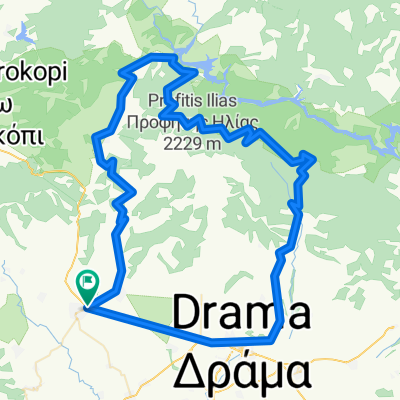
Overview
About this route
- -:--
- Duration
- 119.7 km
- Distance
- 2,019 m
- Ascent
- 2,019 m
- Descent
- ---
- Avg. speed
- ---
- Max. altitude

Route quality
Waytypes & surfaces along the route
Waytypes
Road
52.2 km
(44 %)
Track
43.3 km
(36 %)
Surfaces
Paved
34.6 km
(29 %)
Unpaved
0.3 km
(<1 %)
Asphalt
33.2 km
(28 %)
Paved (undefined)
1.4 km
(1 %)
Continue with Bikemap
Use, edit, or download this cycling route
You would like to ride Mt. Falakro Round or customize it for your own trip? Here is what you can do with this Bikemap route:
Free features
- Save this route as favorite or in collections
- Copy & plan your own version of this route
- Split it into stages to create a multi-day tour
- Sync your route with Garmin or Wahoo
Premium features
Free trial for 3 days, or one-time payment. More about Bikemap Premium.
- Navigate this route on iOS & Android
- Export a GPX / KML file of this route
- Create your custom printout (try it for free)
- Download this route for offline navigation
Discover more Premium features.
Get Bikemap PremiumFrom our community
Other popular routes starting in Prosotsáni
 Climb to to the top of mountain Falakro
- Distance
- 32.6 km
- Ascent
- 2,107 m
- Descent
- 66 m
- Location
- Prosotsáni, East Macedonia and Thrace, Greece
 toxo3
toxo3- Distance
- 54.2 km
- Ascent
- 680 m
- Descent
- 675 m
- Location
- Prosotsáni, East Macedonia and Thrace, Greece
 Prosotsani-ski center Falacro
- Distance
- 28.2 km
- Ascent
- 1,595 m
- Descent
- 55 m
- Location
- Prosotsáni, East Macedonia and Thrace, Greece
 Mt. Falakro Round
- Distance
- 119.7 km
- Ascent
- 2,019 m
- Descent
- 2,019 m
- Location
- Prosotsáni, East Macedonia and Thrace, Greece
Open it in the app