

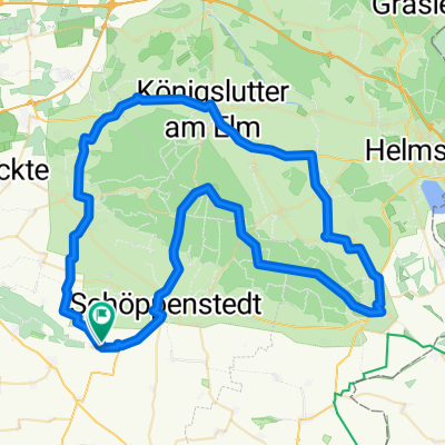
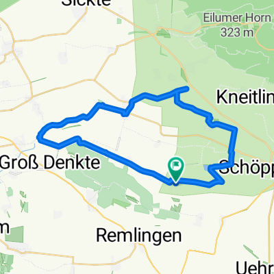
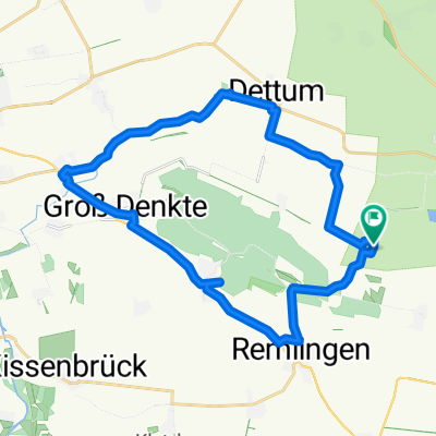
Pontriesen 6, Vahlberg nach Unnamed Road, Schöppenstedt
A cycling route starting in Vahlberg, Lower Saxony, Germany.
Overview
About this route
- 1 h 57 min
- Duration
- 27.8 km
- Distance
- 126 m
- Ascent
- 125 m
- Descent
- 14.2 km/h
- Avg. speed
- ---
- Max. altitude

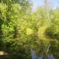
Route photos


Route quality
Waytypes & surfaces along the route
Waytypes
Track
10.6 km
(38 %)
Road
7.5 km
(27 %)
Surfaces
Paved
23.6 km
(85 %)
Unpaved
2.2 km
(8 %)
Asphalt
21.4 km
(77 %)
Paved (undefined)
2.2 km
(8 %)
Continue with Bikemap
Use, edit, or download this cycling route
You would like to ride Pontriesen 6, Vahlberg nach Unnamed Road, Schöppenstedt or customize it for your own trip? Here is what you can do with this Bikemap route:
Free features
- Save this route as favorite or in collections
- Copy & plan your own version of this route
- Sync your route with Garmin or Wahoo
Premium features
Free trial for 3 days, or one-time payment. More about Bikemap Premium.
- Navigate this route on iOS & Android
- Export a GPX / KML file of this route
- Create your custom printout (try it for free)
- Download this route for offline navigation
Discover more Premium features.
Get Bikemap PremiumFrom our community
Other popular routes starting in Vahlberg
 Pontriesen 6, Vahlberg nach Unnamed Road, Schöppenstedt
- Distance
- 27.8 km
- Ascent
- 126 m
- Descent
- 125 m
- Location
- Vahlberg, Lower Saxony, Germany
 Oderwaldstrecke
- Distance
- 62.9 km
- Ascent
- 146 m
- Descent
- 201 m
- Location
- Vahlberg, Lower Saxony, Germany
 Klein Vahlberg-Bornum-Königslutter-Schöningen
- Distance
- 75.1 km
- Ascent
- 481 m
- Descent
- 483 m
- Location
- Vahlberg, Lower Saxony, Germany
 Kleine Tour...
- Distance
- 24.9 km
- Ascent
- 105 m
- Descent
- 105 m
- Location
- Vahlberg, Lower Saxony, Germany
 Pontriesen 6, Vahlberg nach Pontriesen 6, Vahlberg
- Distance
- 27.4 km
- Ascent
- 140 m
- Descent
- 188 m
- Location
- Vahlberg, Lower Saxony, Germany
 Route nach Pontriesen 6, Vahlberg
- Distance
- 24.7 km
- Ascent
- 205 m
- Descent
- 208 m
- Location
- Vahlberg, Lower Saxony, Germany
 Ampleben/Anstieg/Reitlingstal
- Distance
- 21 km
- Ascent
- 271 m
- Descent
- 256 m
- Location
- Vahlberg, Lower Saxony, Germany
 Kneitlingen nach Elmblick 17A, Wolfenbüttel
- Distance
- 17 km
- Ascent
- 60 m
- Descent
- 69 m
- Location
- Vahlberg, Lower Saxony, Germany
Open it in the app