Tailwind 2 -Expressway/Cove Road Route fast group
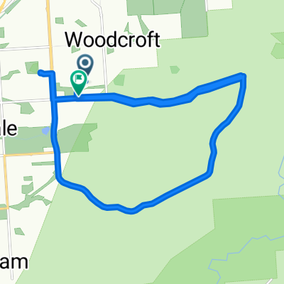
A cycling route starting in Reynella, South Australia, Australia.
Overview
About this route
Expressway Bike Track to Darlington, Along Seacombe Road, Marino, Along Cove Road, on towards Lonsdale, up Mt M.FÂ Â Back on Sherrifs Road, Rejoin Southern Expressway, Sharp right - come off at Oxford Street, onto The Strand and return to Shop.
- -:--
- Duration
- 27.9 km
- Distance
- 360 m
- Ascent
- 360 m
- Descent
- ---
- Avg. speed
- ---
- Avg. speed
Route quality
Waytypes & surfaces along the route
Waytypes
Cycleway
12.2 km
(44 %)
Quiet road
8.5 km
(30 %)
Surfaces
Paved
21.5 km
(77 %)
Unpaved
1.8 km
(6 %)
Asphalt
19.1 km
(68 %)
Paved (undefined)
2.4 km
(9 %)
Continue with Bikemap
Use, edit, or download this cycling route
You would like to ride Tailwind 2 -Expressway/Cove Road Route fast group or customize it for your own trip? Here is what you can do with this Bikemap route:
Free features
- Save this route as favorite or in collections
- Copy & plan your own version of this route
- Sync your route with Garmin or Wahoo
Premium features
Free trial for 3 days, or one-time payment. More about Bikemap Premium.
- Navigate this route on iOS & Android
- Export a GPX / KML file of this route
- Create your custom printout (try it for free)
- Download this route for offline navigation
Discover more Premium features.
Get Bikemap PremiumFrom our community
Other popular routes starting in Reynella
- Expressway Track - Blackwood - Expressway CLONED FROM ROUTE 1238594
- Distance
- 38.4 km
- Ascent
- 471 m
- Descent
- 461 m
- Location
- Reynella, South Australia, Australia
- woodcroft to willunga on coast to vines trail
- Distance
- 53.4 km
- Ascent
- 322 m
- Descent
- 319 m
- Location
- Reynella, South Australia, Australia
- Expressway - Brighton - Marino - hallet Cove - Sheidow Park
- Distance
- 32.2 km
- Ascent
- 333 m
- Descent
- 333 m
- Location
- Reynella, South Australia, Australia
- Tailwind 3 -Cox's Hill, Clarendon, Main Road, Manning Route - Fast CLONED FROM ROUTE 890284
- Distance
- 36.4 km
- Ascent
- 478 m
- Descent
- 478 m
- Location
- Reynella, South Australia, Australia
- Bains, clarendon, mclaren vale, bike track
- Distance
- 47 km
- Ascent
- 534 m
- Descent
- 533 m
- Location
- Reynella, South Australia, Australia
- Tailwind 2 -Expressway/Cove Road Route fast group
- Distance
- 27.9 km
- Ascent
- 360 m
- Descent
- 360 m
- Location
- Reynella, South Australia, Australia
- Tailwind Cox Hill Route
- Distance
- 36.1 km
- Ascent
- 512 m
- Descent
- 512 m
- Location
- Reynella, South Australia, Australia
- humpty route
- Distance
- 32.1 km
- Ascent
- 462 m
- Descent
- 462 m
- Location
- Reynella, South Australia, Australia
Open it in the app