

Dettelbach in den Steigerwald
A cycling route starting in Dettelbach, Bavaria, Germany.
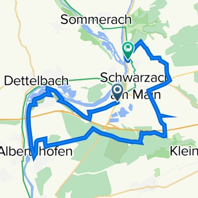
Overview
About this route
Parken am Discounter und dann ab auf den Radweg. Kurzes Stück Bundesstrasse bis Düllstadt und dann eigentlich nur Nebenstrassen. Viel Spaß
- -:--
- Duration
- 67.5 km
- Distance
- 767 m
- Ascent
- 754 m
- Descent
- ---
- Avg. speed
- 480 m
- Max. altitude
Route quality
Waytypes & surfaces along the route
Waytypes
Road
26.7 km
(40 %)
Busy road
23.7 km
(35 %)
Surfaces
Paved
30.8 km
(46 %)
Unpaved
2.8 km
(4 %)
Asphalt
30.2 km
(45 %)
Gravel
2.2 km
(3 %)
Continue with Bikemap
Use, edit, or download this cycling route
You would like to ride Dettelbach in den Steigerwald or customize it for your own trip? Here is what you can do with this Bikemap route:
Free features
- Save this route as favorite or in collections
- Copy & plan your own version of this route
- Sync your route with Garmin or Wahoo
Premium features
Free trial for 3 days, or one-time payment. More about Bikemap Premium.
- Navigate this route on iOS & Android
- Export a GPX / KML file of this route
- Create your custom printout (try it for free)
- Download this route for offline navigation
Discover more Premium features.
Get Bikemap PremiumFrom our community
Other popular routes starting in Dettelbach
 Dettelbach - Retzstadt
- Distance
- 70.9 km
- Ascent
- 109 m
- Descent
- 73 m
- Location
- Dettelbach, Bavaria, Germany
 Dettelbach in den Steigerwald
- Distance
- 67.5 km
- Ascent
- 767 m
- Descent
- 754 m
- Location
- Dettelbach, Bavaria, Germany
 Tag 4 Dettelbach/Bad Bocklet
- Distance
- 73.8 km
- Ascent
- 301 m
- Descent
- 260 m
- Location
- Dettelbach, Bavaria, Germany
 Kripo Radtour 2014 - 2. Tag
- Distance
- 47 km
- Ascent
- 352 m
- Descent
- 258 m
- Location
- Dettelbach, Bavaria, Germany
 B22, Schwarzach am Main nach Schweinfurter Straße 97, Schwarzach am Main
- Distance
- 25.8 km
- Ascent
- 100 m
- Descent
- 96 m
- Location
- Dettelbach, Bavaria, Germany
 17-4DETTELBACH-GEMÜNDEN
- Distance
- 87.5 km
- Ascent
- 83 m
- Descent
- 119 m
- Location
- Dettelbach, Bavaria, Germany
 Genießer-Tour (Tour 2) - Genießer-Tour (Tour 2)
- Distance
- 41 km
- Ascent
- 228 m
- Descent
- 226 m
- Location
- Dettelbach, Bavaria, Germany
 Tag 5 Mainradweg Dettelbach
- Distance
- 9.3 km
- Ascent
- 71 m
- Descent
- 74 m
- Location
- Dettelbach, Bavaria, Germany
Open it in the app