

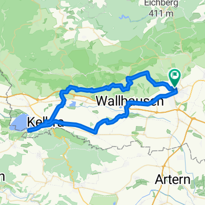
Rund um Sangerhausen
A cycling route starting in Sangerhausen, Saxony-Anhalt, Germany.
Overview
About this route
SGH-Lengefeld-Wickerode-Bennungen-Bridges-Martinsrieth-Oberröblingen-SGH
- -:--
- Duration
- 40.2 km
- Distance
- 206 m
- Ascent
- 223 m
- Descent
- ---
- Avg. speed
- 279 m
- Max. altitude

Route quality
Waytypes & surfaces along the route
Waytypes
Track
12.5 km
(31 %)
Quiet road
7.2 km
(18 %)
Surfaces
Paved
13.7 km
(34 %)
Unpaved
6.4 km
(16 %)
Asphalt
12.9 km
(32 %)
Unpaved (undefined)
4 km
(10 %)
Continue with Bikemap
Use, edit, or download this cycling route
You would like to ride Rund um Sangerhausen or customize it for your own trip? Here is what you can do with this Bikemap route:
Free features
- Save this route as favorite or in collections
- Copy & plan your own version of this route
- Sync your route with Garmin or Wahoo
Premium features
Free trial for 3 days, or one-time payment. More about Bikemap Premium.
- Navigate this route on iOS & Android
- Export a GPX / KML file of this route
- Create your custom printout (try it for free)
- Download this route for offline navigation
Discover more Premium features.
Get Bikemap PremiumFrom our community
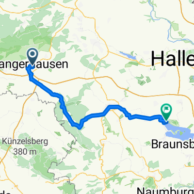
Other popular routes starting in Sangerhausen
 lol ha
- Distance
- 26.6 km
- Ascent
- 272 m
- Descent
- 273 m
- Location
- Sangerhausen, Saxony-Anhalt, Germany
 Sangerhausen-Grillenberg-Waldbad
- Distance
- 10.6 km
- Ascent
- 88 m
- Descent
- 3 m
- Location
- Sangerhausen, Saxony-Anhalt, Germany
 493. Wickerode
- Distance
- 124.6 km
- Ascent
- 1,096 m
- Descent
- 1,063 m
- Location
- Sangerhausen, Saxony-Anhalt, Germany
 SGH 002: Sangerhausen - Hattorf
- Distance
- 91 km
- Ascent
- 333 m
- Descent
- 371 m
- Location
- Sangerhausen, Saxony-Anhalt, Germany
 Roßla
Roßla- Distance
- 30.6 km
- Ascent
- 89 m
- Descent
- 95 m
- Location
- Sangerhausen, Saxony-Anhalt, Germany
 Route nach Südharz
- Distance
- 56.4 km
- Ascent
- 552 m
- Descent
- 553 m
- Location
- Sangerhausen, Saxony-Anhalt, Germany
 Schloßberge, Sangerhausen nach Wasserwerk, Mücheln (Geiseltal)
- Distance
- 55.8 km
- Ascent
- 342 m
- Descent
- 408 m
- Location
- Sangerhausen, Saxony-Anhalt, Germany
 4. Südharztour Sangerhausen
- Distance
- 84.2 km
- Ascent
- 765 m
- Descent
- 765 m
- Location
- Sangerhausen, Saxony-Anhalt, Germany
Open it in the app