
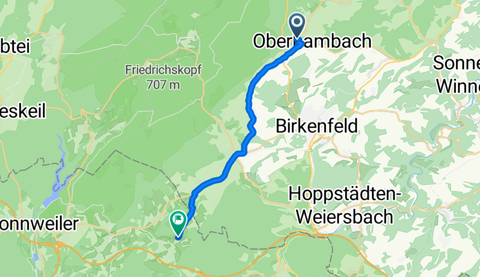
Ferienpark 66, Oberhambach nach Obersötern, Nohfelden
A cycling route starting in Oberhambach, Rhineland-Palatinate, Germany.
Overview
About this route
- 40 min
- Duration
- 13.3 km
- Distance
- 229 m
- Ascent
- 262 m
- Descent
- 20.2 km/h
- Avg. speed
- ---
- Avg. speed
Route quality
Waytypes & surfaces along the route
Waytypes
Road
6.6 km
(50 %)
Busy road
2.7 km
(21 %)
Surfaces
Paved
11.6 km
(87 %)
Asphalt
11.6 km
(87 %)
Undefined
1.7 km
(13 %)
Continue with Bikemap
Use, edit, or download this cycling route
You would like to ride Ferienpark 66, Oberhambach nach Obersötern, Nohfelden or customize it for your own trip? Here is what you can do with this Bikemap route:
Free features
- Save this route as favorite or in collections
- Copy & plan your own version of this route
- Sync your route with Garmin or Wahoo
Premium features
Free trial for 3 days, or one-time payment. More about Bikemap Premium.
- Navigate this route on iOS & Android
- Export a GPX / KML file of this route
- Create your custom printout (try it for free)
- Download this route for offline navigation
Discover more Premium features.
Get Bikemap PremiumFrom our community
Other popular routes starting in Oberhambach
 HamSaar
- Distance
- 63.8 km
- Ascent
- 752 m
- Descent
- 1,011 m
- Location
- Oberhambach, Rhineland-Palatinate, Germany
 An der Nahe
- Distance
- 45.6 km
- Ascent
- 696 m
- Descent
- 694 m
- Location
- Oberhambach, Rhineland-Palatinate, Germany
 Ferienpark 91, Oberhambach nach Maiwiese 3–13, Birkenfeld an der Nahe
- Distance
- 5.3 km
- Ascent
- 88 m
- Descent
- 138 m
- Location
- Oberhambach, Rhineland-Palatinate, Germany
 Ferienpark 68, Oberhambach nach Königsberger Straße 1, Birkenfeld an der Nahe
- Distance
- 6.5 km
- Ascent
- 657 m
- Descent
- 731 m
- Location
- Oberhambach, Rhineland-Palatinate, Germany
 HamHerm
- Distance
- 26.2 km
- Ascent
- 531 m
- Descent
- 482 m
- Location
- Oberhambach, Rhineland-Palatinate, Germany
 L174, Niederhambach nach Hauptstraße 9, Oberhambach
- Distance
- 16 km
- Ascent
- 246 m
- Descent
- 221 m
- Location
- Oberhambach, Rhineland-Palatinate, Germany
 rondje Hattgenstein
- Distance
- 28 km
- Ascent
- 585 m
- Descent
- 585 m
- Location
- Oberhambach, Rhineland-Palatinate, Germany
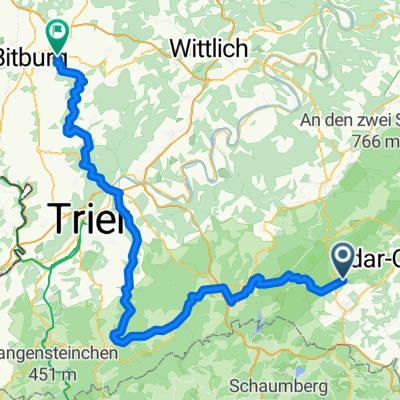 Oberhambach - Trier - Bitburg
- Distance
- 107 km
- Ascent
- 668 m
- Descent
- 846 m
- Location
- Oberhambach, Rhineland-Palatinate, Germany
Open it in the app