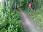
Ruta carril bici, pista asfaltada y caminos.
A cycling route starting in Villa de Vallecas, Madrid, Spain.
Overview
About this route
- Start the route in the area of the Convent of Aldehuela (you can leave your car there).
- Cycle lane M-301 to the roundabout with a detour to Parque Warner, San Martín de la Vega, Gózquez de Abajo and Gózquez de Arriba. We head towards Gózquez de Abajo.
- Upon arriving at Gózquez de Abajo, we take the path parallel to the canal until we reach the asphalted road towards Finca La Boyeriza.
- Continue on the road until Presa del Rey, taking the narrow path that goes up to the left to a brick watchtower.
- Continue along the path, leaving Rivas Vaciamadrid on the right.
- After passing a large building, at the level of the Civil Protection School on the other side of the river, take one of the paths to the left, returning to the wide path we left earlier.
- Continue on the wide path until the ruins of the Bodega de la Aldehuela, circling the bodega until you reach a cow pasture.
- Continue the trail until you return to the cycle lane M-301, arriving back at the Convent of Aldehuela.
- -:--
- Duration
- 33.7 km
- Distance
- 208 m
- Ascent
- 207 m
- Descent
- ---
- Avg. speed
- ---
- Max. altitude
Continue with Bikemap
Use, edit, or download this cycling route
You would like to ride Ruta carril bici, pista asfaltada y caminos. or customize it for your own trip? Here is what you can do with this Bikemap route:
Free features
- Save this route as favorite or in collections
- Copy & plan your own version of this route
- Sync your route with Garmin or Wahoo
Premium features
Free trial for 3 days, or one-time payment. More about Bikemap Premium.
- Navigate this route on iOS & Android
- Export a GPX / KML file of this route
- Create your custom printout (try it for free)
- Download this route for offline navigation
Discover more Premium features.
Get Bikemap PremiumFrom our community
Other popular routes starting in Villa de Vallecas
 De Calle de la Sierra Morena, 32, Madrid a M-30, Madrid
- Distance
- 13.8 km
- Ascent
- 160 m
- Descent
- 144 m
- Location
- Villa de Vallecas, Madrid, Spain
 De Calle el Barraco 16B, Madrid a Calle el Barraco 14I, Madrid
- Distance
- 10.6 km
- Ascent
- 122 m
- Descent
- 123 m
- Location
- Villa de Vallecas, Madrid, Spain
 Ensanche - Paracuellos
- Distance
- 79.2 km
- Ascent
- 510 m
- Descent
- 510 m
- Location
- Villa de Vallecas, Madrid, Spain
 Ruta carril bici, pista asfaltada y caminos.
- Distance
- 33.7 km
- Ascent
- 208 m
- Descent
- 207 m
- Location
- Villa de Vallecas, Madrid, Spain
 Rivas Urbanizaciones - Rivas Pueblo por el cerro del telégrafo
- Distance
- 12.5 km
- Ascent
- 180 m
- Descent
- 216 m
- Location
- Villa de Vallecas, Madrid, Spain
 Por el barrio
- Distance
- 10.5 km
- Ascent
- 336 m
- Descent
- 386 m
- Location
- Villa de Vallecas, Madrid, Spain
 Day 1 - Madrid to Toledo
- Distance
- 100.5 km
- Ascent
- 520 m
- Descent
- 652 m
- Location
- Villa de Vallecas, Madrid, Spain
 valdecarros / la gavia metro
- Distance
- 3.2 km
- Ascent
- 58 m
- Descent
- 84 m
- Location
- Villa de Vallecas, Madrid, Spain
Open it in the app


