

Sella Ronda - clockwise
A cycling route starting in Campitello di Fassa, Trentino-Alto Adige, Italy.
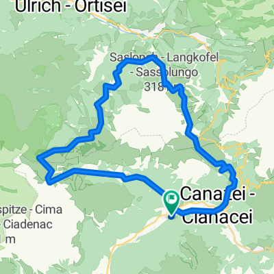
Overview
About this route
We did this is June 2010, starting in Campitello. It was fanstastic weather and took about 7 hours. Definitely needed the winter jacket for the descents.
- -:--
- Duration
- 69.8 km
- Distance
- 2,137 m
- Ascent
- 2,926 m
- Descent
- ---
- Avg. speed
- ---
- Max. altitude

Continue with Bikemap
Use, edit, or download this cycling route
You would like to ride Sella Ronda - clockwise or customize it for your own trip? Here is what you can do with this Bikemap route:
Free features
- Save this route as favorite or in collections
- Copy & plan your own version of this route
- Sync your route with Garmin or Wahoo
Premium features
Free trial for 3 days, or one-time payment. More about Bikemap Premium.
- Navigate this route on iOS & Android
- Export a GPX / KML file of this route
- Create your custom printout (try it for free)
- Download this route for offline navigation
Discover more Premium features.
Get Bikemap PremiumFrom our community
Other popular routes starting in Campitello di Fassa
 giro della Val Duron
- Distance
- 32.6 km
- Ascent
- 869 m
- Descent
- 1,838 m
- Location
- Campitello di Fassa, Trentino-Alto Adige, Italy
 MTB Sellaronda Camp_2 diena_Sassolungo tour
- Distance
- 37.2 km
- Ascent
- 1,407 m
- Descent
- 1,406 m
- Location
- Campitello di Fassa, Trentino-Alto Adige, Italy
 PASSO DI COSTALUNGA LAGO DI CAREZZA
- Distance
- 39.8 km
- Ascent
- 974 m
- Descent
- 1,007 m
- Location
- Campitello di Fassa, Trentino-Alto Adige, Italy
 Dolomites 58, Campitello di Fassa to Piaz de Ciampedel 17, Campitello di Fassa
- Distance
- 25.2 km
- Ascent
- 1,222 m
- Descent
- 1,187 m
- Location
- Campitello di Fassa, Trentino-Alto Adige, Italy
 Day 5
Day 5- Distance
- 88.5 km
- Ascent
- 2,323 m
- Descent
- 2,409 m
- Location
- Campitello di Fassa, Trentino-Alto Adige, Italy
 Sella Ronda
- Distance
- 69.2 km
- Ascent
- 2,343 m
- Descent
- 2,343 m
- Location
- Campitello di Fassa, Trentino-Alto Adige, Italy
 Passo Nigra
- Distance
- 26.1 km
- Ascent
- 536 m
- Descent
- 275 m
- Location
- Campitello di Fassa, Trentino-Alto Adige, Italy
 sasso lungo
- Distance
- 37.2 km
- Ascent
- 1,477 m
- Descent
- 1,478 m
- Location
- Campitello di Fassa, Trentino-Alto Adige, Italy
Open it in the app