

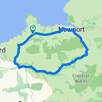
Cilgerran
A cycling route starting in Newport, Wales, United Kingdom.
Overview
About this route
- -:--
- Duration
- 41.4 km
- Distance
- 561 m
- Ascent
- 558 m
- Descent
- ---
- Avg. speed
- ---
- Max. altitude
Route quality
Waytypes & surfaces along the route
Waytypes
Road
22.4 km
(54 %)
Quiet road
13.3 km
(32 %)
Surfaces
Paved
36 km
(87 %)
Asphalt
36 km
(87 %)
Undefined
5.4 km
(13 %)
Continue with Bikemap
Use, edit, or download this cycling route
You would like to ride Cilgerran or customize it for your own trip? Here is what you can do with this Bikemap route:
Free features
- Save this route as favorite or in collections
- Copy & plan your own version of this route
- Sync your route with Garmin or Wahoo
Premium features
Free trial for 3 days, or one-time payment. More about Bikemap Premium.
- Navigate this route on iOS & Android
- Export a GPX / KML file of this route
- Create your custom printout (try it for free)
- Download this route for offline navigation
Discover more Premium features.
Get Bikemap PremiumFrom our community
Other popular routes starting in Newport
 Route to 8 Main St, Fishguard
- Distance
- 15.1 km
- Ascent
- 614 m
- Descent
- 675 m
- Location
- Newport, Wales, United Kingdom
 Poppit Sands
- Distance
- 19.8 km
- Ascent
- 606 m
- Descent
- 634 m
- Location
- Newport, Wales, United Kingdom
 Newport Castles and Sand Castles
- Distance
- 43 km
- Ascent
- 654 m
- Descent
- 638 m
- Location
- Newport, Wales, United Kingdom
 Dinas Island Walk
- Distance
- 15.5 km
- Ascent
- 339 m
- Descent
- 339 m
- Location
- Newport, Wales, United Kingdom
 Gwaun Valley
- Distance
- 24.3 km
- Ascent
- 338 m
- Descent
- 337 m
- Location
- Newport, Wales, United Kingdom
 newport
- Distance
- 25 km
- Ascent
- 594 m
- Descent
- 507 m
- Location
- Newport, Wales, United Kingdom
 Holiday Spin
- Distance
- 39.4 km
- Ascent
- 421 m
- Descent
- 420 m
- Location
- Newport, Wales, United Kingdom
 Standing Stone Tour
- Distance
- 39.1 km
- Ascent
- 665 m
- Descent
- 665 m
- Location
- Newport, Wales, United Kingdom
Open it in the app