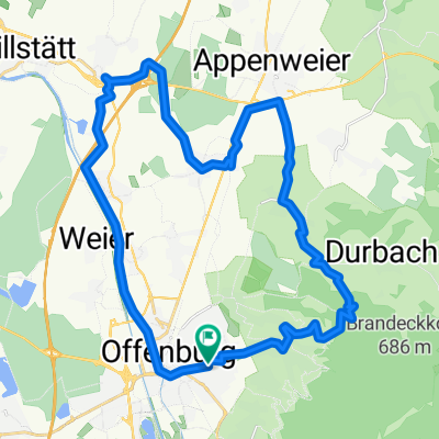
Kornebene
A cycling route starting in Offenburg, Baden-Wurttemberg, Germany.
Overview
About this route
- -:--
- Duration
- 43.8 km
- Distance
- 693 m
- Ascent
- 698 m
- Descent
- ---
- Avg. speed
- ---
- Max. altitude
Route quality
Waytypes & surfaces along the route
Waytypes
Track
18 km
(41 %)
Quiet road
12.7 km
(29 %)
Surfaces
Paved
21.9 km
(50 %)
Unpaved
17.5 km
(40 %)
Asphalt
21 km
(48 %)
Gravel
16.2 km
(37 %)
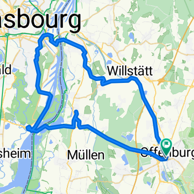
Continue with Bikemap
Use, edit, or download this cycling route
You would like to ride Kornebene or customize it for your own trip? Here is what you can do with this Bikemap route:
Free features
- Save this route as favorite or in collections
- Copy & plan your own version of this route
- Sync your route with Garmin or Wahoo
Premium features
Free trial for 3 days, or one-time payment. More about Bikemap Premium.
- Navigate this route on iOS & Android
- Export a GPX / KML file of this route
- Create your custom printout (try it for free)
- Download this route for offline navigation
Discover more Premium features.
Get Bikemap PremiumFrom our community
Other popular routes starting in Offenburg
Größere Feierabendrunde- Distance
- 49.8 km
- Ascent
- 688 m
- Descent
- 686 m
- Location
- Offenburg, Baden-Wurttemberg, Germany
Offenburg-Weier - Wolfsgrube - Brandecklindle -Ohlsbach zurück- Distance
- 32.4 km
- Ascent
- 510 m
- Descent
- 511 m
- Location
- Offenburg, Baden-Wurttemberg, Germany
Gr2_2012_06_19- Distance
- 47 km
- Ascent
- 29 m
- Descent
- 29 m
- Location
- Offenburg, Baden-Wurttemberg, Germany
Kornebene- Distance
- 43.8 km
- Ascent
- 693 m
- Descent
- 698 m
- Location
- Offenburg, Baden-Wurttemberg, Germany
2009-08-26 0auf2700 Gr1 Flach Rh.bisch.hm- Distance
- 54.3 km
- Ascent
- 65 m
- Descent
- 68 m
- Location
- Offenburg, Baden-Wurttemberg, Germany
Horn/F-Eck/Hirschquelle/Horn- Distance
- 54.2 km
- Ascent
- 1,045 m
- Descent
- 1,045 m
- Location
- Offenburg, Baden-Wurttemberg, Germany
Ruhestein- Distance
- 89 km
- Ascent
- 842 m
- Descent
- 842 m
- Location
- Offenburg, Baden-Wurttemberg, Germany
Renchtalrunde- Distance
- 98.6 km
- Ascent
- 1,344 m
- Descent
- 1,345 m
- Location
- Offenburg, Baden-Wurttemberg, Germany
Open it in the app


