

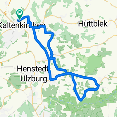
Kaki-Runde 25
A cycling route starting in Kaltenkirchen, Schleswig-Holstein, Germany.
Overview
About this route
- -:--
- Duration
- 30.7 km
- Distance
- 111 m
- Ascent
- 112 m
- Descent
- ---
- Avg. speed
- ---
- Max. altitude
Route quality
Waytypes & surfaces along the route
Waytypes
Quiet road
11.4 km
(37 %)
Path
6.1 km
(20 %)
Surfaces
Paved
27.9 km
(91 %)
Unpaved
0.3 km
(1 %)
Asphalt
27.6 km
(90 %)
Paved (undefined)
0.3 km
(1 %)
Continue with Bikemap
Use, edit, or download this cycling route
You would like to ride Kaki-Runde 25 or customize it for your own trip? Here is what you can do with this Bikemap route:
Free features
- Save this route as favorite or in collections
- Copy & plan your own version of this route
- Sync your route with Garmin or Wahoo
Premium features
Free trial for 3 days, or one-time payment. More about Bikemap Premium.
- Navigate this route on iOS & Android
- Export a GPX / KML file of this route
- Create your custom printout (try it for free)
- Download this route for offline navigation
Discover more Premium features.
Get Bikemap PremiumFrom our community
Other popular routes starting in Kaltenkirchen
 Cross im Park - Kaltenkirchen
- Distance
- 2.1 km
- Ascent
- 8 m
- Descent
- 9 m
- Location
- Kaltenkirchen, Schleswig-Holstein, Germany
 Schmalfelder Au
- Distance
- 19.4 km
- Ascent
- 52 m
- Descent
- 47 m
- Location
- Kaltenkirchen, Schleswig-Holstein, Germany
 Spätabends...
- Distance
- 36.1 km
- Ascent
- 65 m
- Descent
- 72 m
- Location
- Kaltenkirchen, Schleswig-Holstein, Germany
 Kaki-Hasenmoor-Kaffeetour
- Distance
- 29.2 km
- Ascent
- 92 m
- Descent
- 95 m
- Location
- Kaltenkirchen, Schleswig-Holstein, Germany
 Schöne Radstrecke (ca 1 Std..)
- Distance
- 23.3 km
- Ascent
- 69 m
- Descent
- 72 m
- Location
- Kaltenkirchen, Schleswig-Holstein, Germany
 Kaki-Runde 01
- Distance
- 18.4 km
- Ascent
- 47 m
- Descent
- 46 m
- Location
- Kaltenkirchen, Schleswig-Holstein, Germany
 Oersdorf - Winsen - Kisdorf - Götzberg - Wakendorf II - Ulzburg - Kisdorf
- Distance
- 32.4 km
- Ascent
- 120 m
- Descent
- 123 m
- Location
- Kaltenkirchen, Schleswig-Holstein, Germany
 Kaltenkirchen - Schmalfeld, Oesdorf
- Distance
- 15 km
- Ascent
- 63 m
- Descent
- 60 m
- Location
- Kaltenkirchen, Schleswig-Holstein, Germany
Open it in the app