Infrastructure Tour
A cycling route starting in Winnipeg, Manitoba, Canada.
Overview
About this route
- -:--
- Duration
- 10.6 km
- Distance
- 68 m
- Ascent
- 65 m
- Descent
- ---
- Avg. speed
- ---
- Max. altitude
Route quality
Waytypes & surfaces along the route
Waytypes
Road
4.1 km
(39 %)
Cycleway
2.1 km
(20 %)
Surfaces
Paved
9.3 km
(88 %)
Concrete
5 km
(47 %)
Asphalt
3.8 km
(36 %)
Route highlights
Points of interest along the route

Point of interest after 0 km
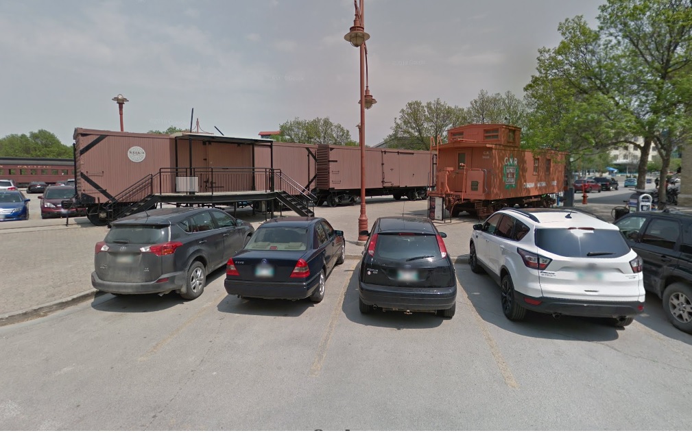
The WRENCH Satellite Location. Open for sales and parts Wed, 4 - 8 pm and Sat. 1 - 7 pm. Open for sales Sun. 12 - 6 pm.

Point of interest after 0.1 km
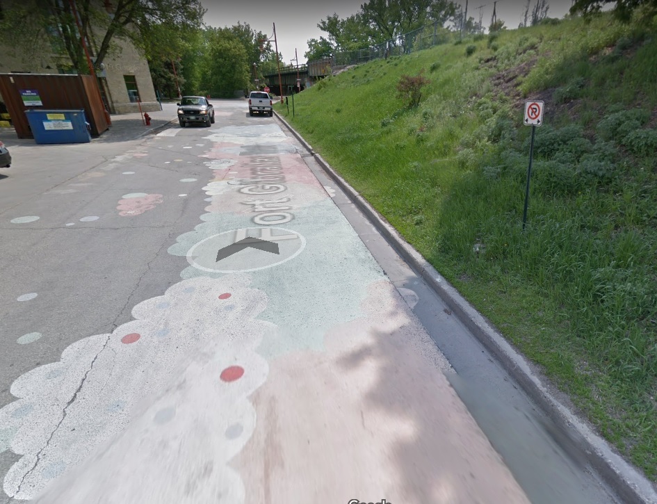
Fort Gibraltar Trail - The Forks used paint and speed humps along this stretch to try and slow traffic.

Point of interest after 0.2 km
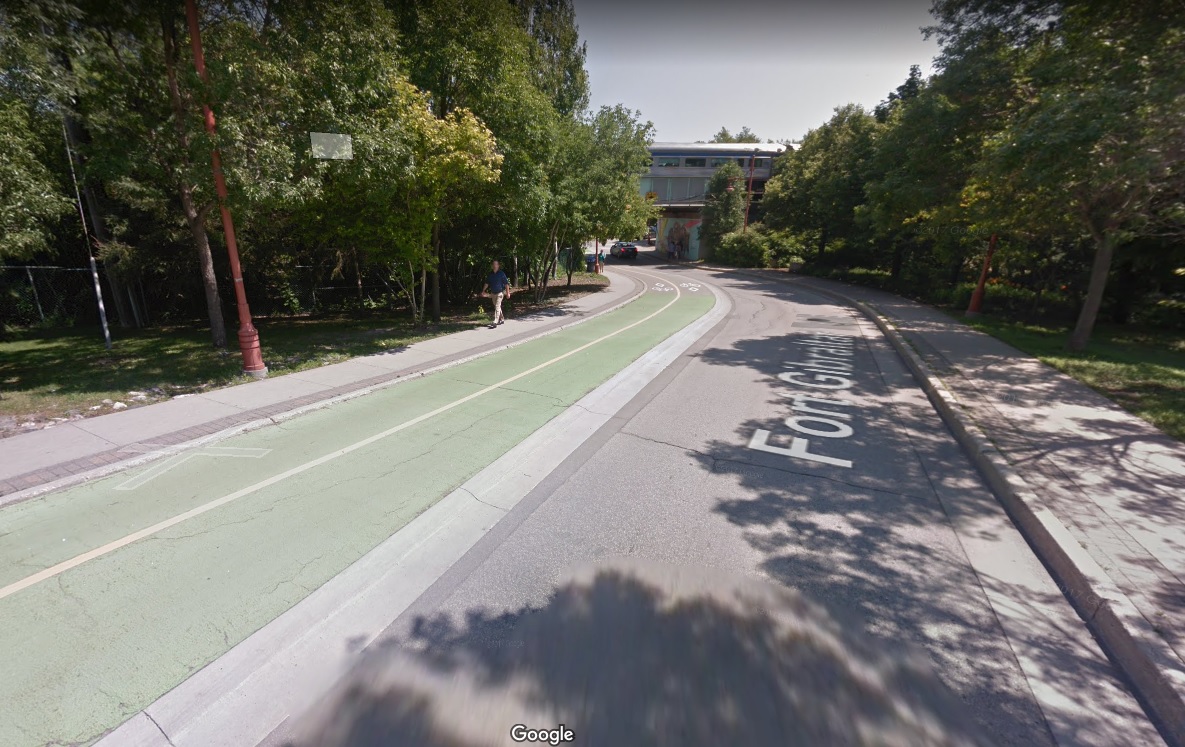
Fort Gibraltar Trail - This is the first raised bike lane in Winnipeg and also the first use of green thermoplast on the surface. The Forks provided some of the left over to the city to use in highlight conflict zones. Another first is the electronic counter whose results are updated on the city's open data site. (https://bit.ly/3z5C8AK)

Point of interest after 0.3 km
Sidewalk Connection - Currently bikes need to use the sidewalk to access the bike x-ing at Main & Assiniboine. A new connection is to be completed in 2021.

Point of interest after 0.3 km
Bike X-ing - Main Street - This crossing is a critical link in the network due to the connection to Assiniboine and because Main is so busy. There have been some conflicts with turning vehicles in particular those turning from Assiniboine onto Main Street south. Cyclists need to remain alert to turning vehicles.

Point of interest after 1.4 km
Garry Street bi-directional bike lane - This 2 way bike lane is an important north/south link in the downtown. Advocates would have preferred one way protected bike lanes on Fort & Garry however most people are still very happy to have the Garry Street facility. The large number of driveways/parking lots along the route have created some conflicts with crossing vehicles and because the lights are timed for southbound traffic it can created some issues with flow heading north.

Point of interest after 1.7 km
Arthur Street Contra-flow Bike Lane - One of only a few bike lanes that flow against the direction of vehicle traffic. This is an important link to the McDermot protected bike lane. Intended to be one way however there has been some confusion due to the "except cyclists" signage at McDermot that is intended to warn drivers of bikes coming against the flow of traffic. Adding a directional arrow in these one-way bike lanes would help.

Point of interest after 1.8 km
McDermot Protected Bike Lane.

Point of interest after 1.8 km
Two stage turn lane - For those wishing to get to Bannatyne or Old Market Square there is a two-stage turn lane painted to the right of the protected bike lane. You're can pull out of the McDermot bike lane and wait in the turn lane for the light to change and proceed north on Albert.

Point of interest after 1.9 km
Leading green interval for bikes - These lights give bikes and pedestrians a head start entering the intersection before vehicles are permitted to proceed in particular those turning right.

Point of interest after 2.1 km
Protected bike lane changes to a sharrow - Sharrows are intended to indicate to vehicles to share the road. Bikes should remain a minimum of 1 meter from the curb and where it is not possible to share the lane, take the lane.

Point of interest after 2.9 km
Bannatyne planter protected bike lane.

Point of interest after 3.7 km
Ellen Contra-flow bike lane - If you want to head to Red River College etc turning here and taking the contra-flow bike lane north Ellen and follow the counterflow bike lane, cross William and continue on Ellen which will take you to Alexander, which provides connections west of Arlington all the way to Red River College. (with a bit of weaving)

Point of interest after 4.5 km
Bannatyne Protected Bike Lane ends - The bike lane ends at Furby where you must head south on Furby to the McDermot 2 way bike lane to continue west. There is a green two-stage turn on Furby to help make the turn off of Bannatyne onto southbound Furby.

Point of interest after 4.6 km
Cross McDermot into the 2 way bike lane heading west.

Point of interest after 5.7 km
Maryland painted bike lane against the curb on the right side.

Point of interest after 6.3 km
Painted bike lane swings right around the bus stop and shelter.

Point of interest after 6.8 km
Bike lane swings right around bus stop and continues past high school building before returning to a painted bike lane on the right side.
Point of interest after 7.3 km
There is an option here to take a longer ride on 2 of the city's Enhanced Summer Bike Routes. A separate map is provided to show the route.
Point of interest after 7.9 km
This route between Maryland and Osborne will be upgraded to include protected bike lanes in 2021. For more information on the recommended design see https://bit.ly/3wa96ye

Point of interest after 8.5 km
Osborne bike X-ing - This crossing is an important link to Assiniboine as at times the path under the bridge is flooded and at night it is unlit.

Point of interest after 9.2 km
Assiniboine Protected Bike Lane - This is one of the most used and important downtown bike lanes. Bike traffic along Assiniboine skyrocketed after installation of the bike lane and have continued to climb ever since. For several years after the installation building construction on the river side of Assiniboine caused sometimes awkward detours.
Continue with Bikemap
Use, edit, or download this cycling route
You would like to ride Infrastructure Tour or customize it for your own trip? Here is what you can do with this Bikemap route:
Free features
- Save this route as favorite or in collections
- Copy & plan your own version of this route
- Sync your route with Garmin or Wahoo
Premium features
Free trial for 3 days, or one-time payment. More about Bikemap Premium.
- Navigate this route on iOS & Android
- Export a GPX / KML file of this route
- Create your custom printout (try it for free)
- Download this route for offline navigation
Discover more Premium features.
Get Bikemap PremiumFrom our community
Other popular routes starting in Winnipeg
 South St. Vital Loop
- Distance
- 14.8 km
- Ascent
- 18 m
- Descent
- 16 m
- Location
- Winnipeg, Manitoba, Canada
 Forks Route
- Distance
- 9.6 km
- Ascent
- 45 m
- Descent
- 44 m
- Location
- Winnipeg, Manitoba, Canada
 I fell 💪
- Distance
- 15.9 km
- Ascent
- 420 m
- Descent
- 230 m
- Location
- Winnipeg, Manitoba, Canada
 Infrastructure Tour
- Distance
- 10.6 km
- Ascent
- 68 m
- Descent
- 65 m
- Location
- Winnipeg, Manitoba, Canada
 Spence Neighbourhood/Wolseley Garden Tour
- Distance
- 6.4 km
- Ascent
- 17 m
- Descent
- 17 m
- Location
- Winnipeg, Manitoba, Canada
 Bourkevale/St Matthews Route
- Distance
- 8.7 km
- Ascent
- 8 m
- Descent
- 4 m
- Location
- Winnipeg, Manitoba, Canada
 Riverview/Lord Roberts Community Garden Tour
- Distance
- 6.7 km
- Ascent
- 15 m
- Descent
- 15 m
- Location
- Winnipeg, Manitoba, Canada
 Gateway - Peguis - Scotia
- Distance
- 26.8 km
- Ascent
- 26 m
- Descent
- 27 m
- Location
- Winnipeg, Manitoba, Canada
Open it in the app


