
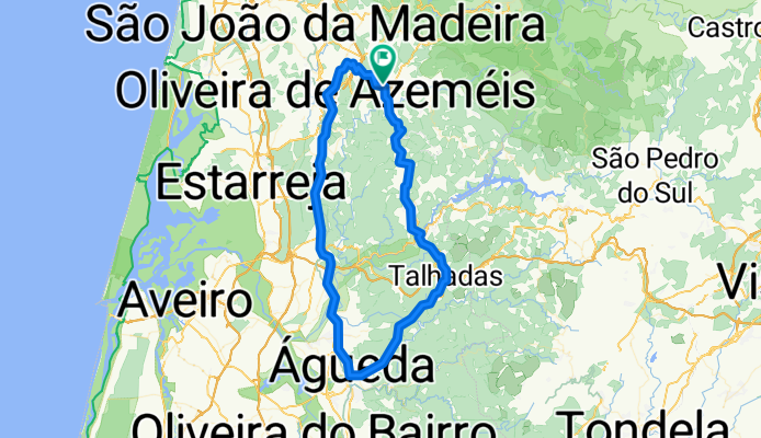
volta pelas talhadas
A cycling route starting in Vale de Cambra, Aveiro District, Portugal.
Overview
About this route
- 5 h 10 min
- Duration
- 89.1 km
- Distance
- 2,845 m
- Ascent
- 2,845 m
- Descent
- 17.2 km/h
- Avg. speed
- ---
- Max. altitude

Route quality
Waytypes & surfaces along the route
Waytypes
Busy road
35.3 km
(40 %)
Quiet road
31.8 km
(36 %)
Surfaces
Paved
37.6 km
(42 %)
Unpaved
0.8 km
(<1 %)
Asphalt
37.3 km
(42 %)
Unpaved (undefined)
0.4 km
(<1 %)
Continue with Bikemap
Use, edit, or download this cycling route
You would like to ride volta pelas talhadas or customize it for your own trip? Here is what you can do with this Bikemap route:
Free features
- Save this route as favorite or in collections
- Copy & plan your own version of this route
- Split it into stages to create a multi-day tour
- Sync your route with Garmin or Wahoo
Premium features
Free trial for 3 days, or one-time payment. More about Bikemap Premium.
- Navigate this route on iOS & Android
- Export a GPX / KML file of this route
- Create your custom printout (try it for free)
- Download this route for offline navigation
Discover more Premium features.
Get Bikemap PremiumFrom our community
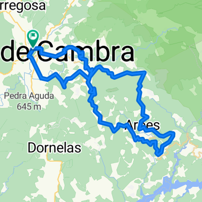
Other popular routes starting in Vale de Cambra
 Free Trail da Castanha 2020 - Oficial
- Distance
- 14.3 km
- Ascent
- 895 m
- Descent
- 894 m
- Location
- Vale de Cambra, Aveiro District, Portugal
 domingo
- Distance
- 176.9 km
- Ascent
- 1,188 m
- Descent
- 1,186 m
- Location
- Vale de Cambra, Aveiro District, Portugal
 De Rua do Gueide 167, Vale de Cambra a Rua do Gueide 167, Vale de Cambra
- Distance
- 49 km
- Ascent
- 1,259 m
- Descent
- 1,261 m
- Location
- Vale de Cambra, Aveiro District, Portugal
 Vale de Cambra - São Macário por sSPSul
- Distance
- 129.3 km
- Ascent
- 2,187 m
- Descent
- 2,105 m
- Location
- Vale de Cambra, Aveiro District, Portugal
 São Pedro do Sul
- Distance
- 109.1 km
- Ascent
- 2,946 m
- Descent
- 2,947 m
- Location
- Vale de Cambra, Aveiro District, Portugal
 Rota da Castanha
- Distance
- 14.3 km
- Ascent
- 992 m
- Descent
- 991 m
- Location
- Vale de Cambra, Aveiro District, Portugal
 De Rua dos Cadavais 111 a Rua dos Cadavais 109
- Distance
- 62.8 km
- Ascent
- 1,565 m
- Descent
- 1,554 m
- Location
- Vale de Cambra, Aveiro District, Portugal
 volta pelas talhadas
- Distance
- 89.1 km
- Ascent
- 2,845 m
- Descent
- 2,845 m
- Location
- Vale de Cambra, Aveiro District, Portugal
Open it in the app