

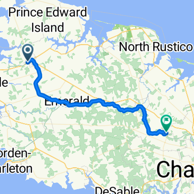
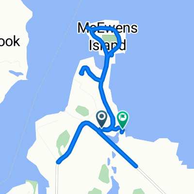
kennsigton malpeque loop
A cycling route starting in Kensington, Prince Edward Island, Canada.
Overview
About this route
- -:--
- Duration
- 36.6 km
- Distance
- 226 m
- Ascent
- 228 m
- Descent
- ---
- Avg. speed
- ---
- Max. altitude
Route quality
Waytypes & surfaces along the route
Waytypes
Road
19 km
(52 %)
Quiet road
0.7 km
(2 %)
Surfaces
Paved
35.5 km
(97 %)
Unpaved
1.1 km
(3 %)
Paved (undefined)
35.5 km
(97 %)
Ground
1.1 km
(3 %)
Continue with Bikemap
Use, edit, or download this cycling route
You would like to ride kennsigton malpeque loop or customize it for your own trip? Here is what you can do with this Bikemap route:
Free features
- Save this route as favorite or in collections
- Copy & plan your own version of this route
- Sync your route with Garmin or Wahoo
Premium features
Free trial for 3 days, or one-time payment. More about Bikemap Premium.
- Navigate this route on iOS & Android
- Export a GPX / KML file of this route
- Create your custom printout (try it for free)
- Download this route for offline navigation
Discover more Premium features.
Get Bikemap PremiumFrom our community
Other popular routes starting in Kensington
 kennsigton malpeque loop
- Distance
- 36.6 km
- Ascent
- 226 m
- Descent
- 228 m
- Location
- Kensington, Prince Edward Island, Canada
 Breadalbane/Borden/Summerside
- Distance
- 66.4 km
- Ascent
- 203 m
- Descent
- 209 m
- Location
- Kensington, Prince Edward Island, Canada
 kensington malpec
- Distance
- 39.1 km
- Ascent
- 182 m
- Descent
- 150 m
- Location
- Kensington, Prince Edward Island, Canada
 Kensington - Cornwall
- Distance
- 42.5 km
- Ascent
- 236 m
- Descent
- 211 m
- Location
- Kensington, Prince Edward Island, Canada
 Route 20, St. David's Parish to St. David's Parish
- Distance
- 5.8 km
- Ascent
- 23 m
- Descent
- 29 m
- Location
- Kensington, Prince Edward Island, Canada
 Hebrides Lane to Hebrides Lane
- Distance
- 9.4 km
- Ascent
- 32 m
- Descent
- 20 m
- Location
- Kensington, Prince Edward Island, Canada
 PEI Day 2b
- Distance
- 81.3 km
- Ascent
- 254 m
- Descent
- 260 m
- Location
- Kensington, Prince Edward Island, Canada
 Sandcastle Lane 14, Kensington to Kensington
- Distance
- 17 km
- Ascent
- 128 m
- Descent
- 94 m
- Location
- Kensington, Prince Edward Island, Canada
Open it in the app