

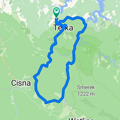
Dworska 4a, Polańczyk do Dworska 4a, Polańczyk
A cycling route starting in Polańczyk, Subcarpathian Voivodeship, Poland.
Overview
About this route
- 10 h 28 min
- Duration
- 89.9 km
- Distance
- 1,153 m
- Ascent
- 1,161 m
- Descent
- 8.6 km/h
- Avg. speed
- ---
- Max. altitude

Route photos


Route quality
Waytypes & surfaces along the route
Waytypes
Road
10.8 km
(12 %)
Quiet road
9 km
(10 %)
Surfaces
Paved
71 km
(79 %)
Unpaved
5.4 km
(6 %)
Asphalt
70.1 km
(78 %)
Ground
5.4 km
(6 %)
Continue with Bikemap
Use, edit, or download this cycling route
You would like to ride Dworska 4a, Polańczyk do Dworska 4a, Polańczyk or customize it for your own trip? Here is what you can do with this Bikemap route:
Free features
- Save this route as favorite or in collections
- Copy & plan your own version of this route
- Split it into stages to create a multi-day tour
- Sync your route with Garmin or Wahoo
Premium features
Free trial for 3 days, or one-time payment. More about Bikemap Premium.
- Navigate this route on iOS & Android
- Export a GPX / KML file of this route
- Create your custom printout (try it for free)
- Download this route for offline navigation
Discover more Premium features.
Get Bikemap PremiumFrom our community
Other popular routes starting in Polańczyk
 Bezmiechowa-Słonne-Arłamów
- Distance
- 200.8 km
- Ascent
- 1,664 m
- Descent
- 1,664 m
- Location
- Polańczyk, Subcarpathian Voivodeship, Poland
 wycieczka rekreacyjna
- Distance
- 46.4 km
- Ascent
- 580 m
- Descent
- 577 m
- Location
- Polańczyk, Subcarpathian Voivodeship, Poland
 Dworska 4a, Polańczyk do Dworska 4b, Polańczyk
- Distance
- 63.4 km
- Ascent
- 823 m
- Descent
- 796 m
- Location
- Polańczyk, Subcarpathian Voivodeship, Poland
 Rajskie-Tołsta
- Distance
- 14.3 km
- Ascent
- 385 m
- Descent
- 386 m
- Location
- Polańczyk, Subcarpathian Voivodeship, Poland
 Polańczyk-Uherce
- Distance
- 35.4 km
- Ascent
- 410 m
- Descent
- 414 m
- Location
- Polańczyk, Subcarpathian Voivodeship, Poland
 Do Wodogrzmotów
- Distance
- 37.5 km
- Ascent
- 585 m
- Descent
- 585 m
- Location
- Polańczyk, Subcarpathian Voivodeship, Poland
 Dworska 4a, Polańczyk do Dworska 4a, Polańczyk
- Distance
- 89.9 km
- Ascent
- 1,153 m
- Descent
- 1,161 m
- Location
- Polańczyk, Subcarpathian Voivodeship, Poland
 Rajskie - Zatwarnica - Rajskie
- Distance
- 31.9 km
- Ascent
- 530 m
- Descent
- 523 m
- Location
- Polańczyk, Subcarpathian Voivodeship, Poland
Open it in the app