Box Hill
A cycling route starting in Banstead, England, United Kingdom.
Overview
About this route
- -:--
- Duration
- 35 km
- Distance
- 346 m
- Ascent
- 346 m
- Descent
- ---
- Avg. speed
- ---
- Max. altitude
Route quality
Waytypes & surfaces along the route
Waytypes
Quiet road
14.8 km
(42 %)
Busy road
12.5 km
(36 %)
Surfaces
Paved
24 km
(68 %)
Unpaved
1.3 km
(4 %)
Asphalt
24 km
(68 %)
Ground
1.3 km
(4 %)
Undefined
9.7 km
(28 %)
Continue with Bikemap
Use, edit, or download this cycling route
You would like to ride Box Hill or customize it for your own trip? Here is what you can do with this Bikemap route:
Free features
- Save this route as favorite or in collections
- Copy & plan your own version of this route
- Sync your route with Garmin or Wahoo
Premium features
Free trial for 3 days, or one-time payment. More about Bikemap Premium.
- Navigate this route on iOS & Android
- Export a GPX / KML file of this route
- Create your custom printout (try it for free)
- Download this route for offline navigation
Discover more Premium features.
Get Bikemap PremiumFrom our community
Other popular routes starting in Banstead
- epsom downs- ashted
- Distance
- 32.1 km
- Ascent
- 396 m
- Descent
- 453 m
- Location
- Banstead, England, United Kingdom
- Surrey Hills and beyond
- Distance
- 109.7 km
- Ascent
- 1,001 m
- Descent
- 1,001 m
- Location
- Banstead, England, United Kingdom
- Steady ride in Banstead
- Distance
- 18 km
- Ascent
- 200 m
- Descent
- 196 m
- Location
- Banstead, England, United Kingdom
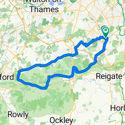
- Epson Down to Box Hil on National route 22
- Distance
- 19.9 km
- Ascent
- 320 m
- Descent
- 260 m
- Location
- Banstead, England, United Kingdom
- Bolters Lane 17 to Du Cane Court
- Distance
- 16.3 km
- Ascent
- 100 m
- Descent
- 225 m
- Location
- Banstead, England, United Kingdom
- Box Hill
- Distance
- 35 km
- Ascent
- 346 m
- Descent
- 346 m
- Location
- Banstead, England, United Kingdom
- Banstead - Mogador
- Distance
- 19.6 km
- Ascent
- 168 m
- Descent
- 171 m
- Location
- Banstead, England, United Kingdom
- Banstead Downs Golf Club, 1 Railway Cottages, Banstead to Belmont Rise, Cheam, Sutton
- Distance
- 3.5 km
- Ascent
- 3 m
- Descent
- 72 m
- Location
- Banstead, England, United Kingdom
Open it in the app