

1989 - In den Südosten Europas - 05. Tag - Sárvár - Balatonföldvár
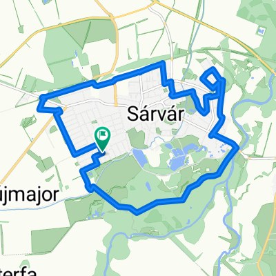
A cycling route starting in Sárvár, Vas County, Hungary.
Overview
About this route
- -:--
- Duration
- 113.6 km
- Distance
- 361 m
- Ascent
- 408 m
- Descent
- ---
- Avg. speed
- ---
- Max. altitude

Continue with Bikemap
Use, edit, or download this cycling route
You would like to ride 1989 - In den Südosten Europas - 05. Tag - Sárvár - Balatonföldvár or customize it for your own trip? Here is what you can do with this Bikemap route:
Free features
- Save this route as favorite or in collections
- Copy & plan your own version of this route
- Split it into stages to create a multi-day tour
- Sync your route with Garmin or Wahoo
Premium features
Free trial for 3 days, or one-time payment. More about Bikemap Premium.
- Navigate this route on iOS & Android
- Export a GPX / KML file of this route
- Create your custom printout (try it for free)
- Download this route for offline navigation
Discover more Premium features.
Get Bikemap PremiumFrom our community
Other popular routes starting in Sárvár
 Lengthy ride through Sárvár
- Distance
- 34 km
- Ascent
- 85 m
- Descent
- 85 m
- Location
- Sárvár, Vas County, Hungary
 Sárvár belvárosi körút 14 km
- Distance
- 14 km
- Ascent
- 24 m
- Descent
- 25 m
- Location
- Sárvár, Vas County, Hungary
 07-Sarvar-Szombathely-1
- Distance
- 35.6 km
- Ascent
- 72 m
- Descent
- 13 m
- Location
- Sárvár, Vas County, Hungary
 Sárvár - Szeleste arborétum
- Distance
- 30.6 km
- Ascent
- 52 m
- Descent
- 49 m
- Location
- Sárvár, Vas County, Hungary
 Ungarntour etappe 3 Sarvar-Balatonfüred gps
- Distance
- 142.2 km
- Ascent
- 587 m
- Descent
- 621 m
- Location
- Sárvár, Vas County, Hungary
 VELOREGIO_02.
- Distance
- 181.1 km
- Ascent
- 227 m
- Descent
- 224 m
- Location
- Sárvár, Vas County, Hungary
 1989 - In den Südosten Europas - 05. Tag - Sárvár - Balatonföldvár
- Distance
- 113.6 km
- Ascent
- 361 m
- Descent
- 408 m
- Location
- Sárvár, Vas County, Hungary
 Sárvár - Szajki tavak - Sárvár
- Distance
- 72.5 km
- Ascent
- 385 m
- Descent
- 385 m
- Location
- Sárvár, Vas County, Hungary
Open it in the app