

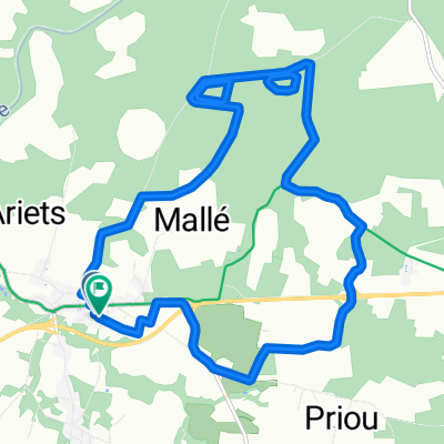
De 12 Route des Pins, Carcarès-Sainte-Croix à 2 Esplanade des Gascons, Anglet
A cycling route starting in Meilhan, Nouvelle-Aquitaine, France.
Overview
About this route
- 6 h 2 min
- Duration
- 96.6 km
- Distance
- 588 m
- Ascent
- 653 m
- Descent
- 16 km/h
- Avg. speed
- ---
- Max. altitude

Route quality
Waytypes & surfaces along the route
Waytypes
Road
41.7 km
(43 %)
Quiet road
36.4 km
(38 %)
Surfaces
Paved
33.1 km
(34 %)
Asphalt
32.6 km
(34 %)
Concrete
0.5 km
(<1 %)
Continue with Bikemap
Use, edit, or download this cycling route
You would like to ride De 12 Route des Pins, Carcarès-Sainte-Croix à 2 Esplanade des Gascons, Anglet or customize it for your own trip? Here is what you can do with this Bikemap route:
Free features
- Save this route as favorite or in collections
- Copy & plan your own version of this route
- Split it into stages to create a multi-day tour
- Sync your route with Garmin or Wahoo
Premium features
Free trial for 3 days, or one-time payment. More about Bikemap Premium.
- Navigate this route on iOS & Android
- Export a GPX / KML file of this route
- Create your custom printout (try it for free)
- Download this route for offline navigation
Discover more Premium features.
Get Bikemap PremiumFrom our community
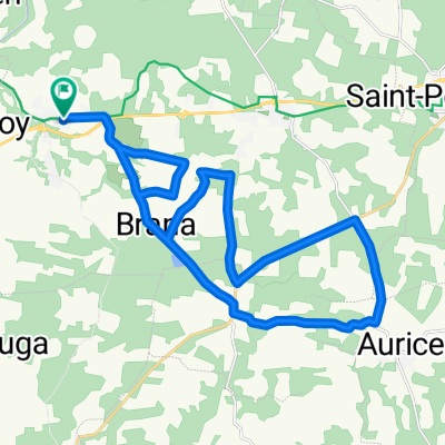
Other popular routes starting in Meilhan
 De Lelane, Saint-Yaguen à Lelane, Saint-Yaguen
- Distance
- 2.1 km
- Ascent
- 8 m
- Descent
- 6 m
- Location
- Meilhan, Nouvelle-Aquitaine, France
 De Rue du Trouilh à Rue du Trouilh
- Distance
- 15.9 km
- Ascent
- 65 m
- Descent
- 128 m
- Location
- Meilhan, Nouvelle-Aquitaine, France
 De Rue du Trouilh à Rue du Trouilh
- Distance
- 28.2 km
- Ascent
- 101 m
- Descent
- 138 m
- Location
- Meilhan, Nouvelle-Aquitaine, France
 De 12 Route des Pins, Carcarès-Sainte-Croix à 2 Esplanade des Gascons, Anglet
- Distance
- 96.6 km
- Ascent
- 588 m
- Descent
- 653 m
- Location
- Meilhan, Nouvelle-Aquitaine, France
 De Rue du Trouilh à Rue du Trouilh
- Distance
- 34.2 km
- Ascent
- 122 m
- Descent
- 183 m
- Location
- Meilhan, Nouvelle-Aquitaine, France
 Une course folle
- Distance
- 28.2 km
- Ascent
- 66 m
- Descent
- 117 m
- Location
- Meilhan, Nouvelle-Aquitaine, France
 Circuit Jerome
- Distance
- 78.8 km
- Ascent
- 482 m
- Descent
- 482 m
- Location
- Meilhan, Nouvelle-Aquitaine, France
 De Rue du Trouilh à Rue du Trouilh
- Distance
- 36.2 km
- Ascent
- 150 m
- Descent
- 189 m
- Location
- Meilhan, Nouvelle-Aquitaine, France
Open it in the app