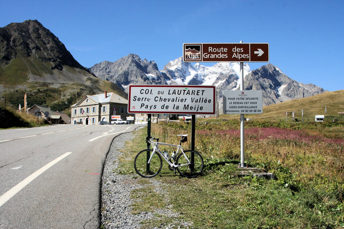
**09-D. Briançon - Lac de la Grande Léchère (157,3 Km)
A cycling route starting in Briançon, Provence-Alpes-Côte d'Azur Region, France.
Overview
About this route
- -:--
- Duration
- 157.3 km
- Distance
- 5,824 m
- Ascent
- 5,355 m
- Descent
- ---
- Avg. speed
- 2,058 m
- Max. altitude
Route quality
Waytypes & surfaces along the route
Waytypes
Road
25.2 km
(16 %)
Quiet road
12.6 km
(8 %)
Surfaces
Paved
108.6 km
(69 %)
Asphalt
108.6 km
(69 %)
Undefined
48.8 km
(31 %)
Route highlights
Points of interest along the route

Point of interest after 27.2 km
Col du LAUTARET (HC) Km 27,5 · 2.057 m
Point of interest after 68.6 km
Sprint LE BOURG-D'OISANS Km 67

Point of interest after 81.5 km
Pas de la CONFESSION (1) Km 80,2 · 1.542 m

Point of interest after 119.9 km
Col du GLANDON (HC) Km 118,8 · 1.924 m

Point of interest after 157.3 km
LAC GRANDE LÉCHÈRE (HC) Km 157,3 · 1.690 m
Continue with Bikemap
Use, edit, or download this cycling route
You would like to ride **09-D. Briançon - Lac de la Grande Léchère (157,3 Km) or customize it for your own trip? Here is what you can do with this Bikemap route:
Free features
- Save this route as favorite or in collections
- Copy & plan your own version of this route
- Split it into stages to create a multi-day tour
- Sync your route with Garmin or Wahoo
Premium features
Free trial for 3 days, or one-time payment. More about Bikemap Premium.
- Navigate this route on iOS & Android
- Export a GPX / KML file of this route
- Create your custom printout (try it for free)
- Download this route for offline navigation
Discover more Premium features.
Get Bikemap PremiumFrom our community
Other popular routes starting in Briançon
 Izoard - Agnel + Izoard
- Distance
- 140 km
- Ascent
- 2,927 m
- Descent
- 2,931 m
- Location
- Briançon, Provence-Alpes-Côte d'Azur Region, France
 briancon-izoard
- Distance
- 20.4 km
- Ascent
- 1,201 m
- Descent
- 155 m
- Location
- Briançon, Provence-Alpes-Côte d'Azur Region, France
 **09-D. Briançon - Lac de la Grande Léchère (157,3 Km)
- Distance
- 157.3 km
- Ascent
- 5,824 m
- Descent
- 5,355 m
- Location
- Briançon, Provence-Alpes-Côte d'Azur Region, France
 Izoard
- Distance
- 83.4 km
- Ascent
- 1,566 m
- Descent
- 1,566 m
- Location
- Briançon, Provence-Alpes-Côte d'Azur Region, France
 Col du Galibier via the old road
- Distance
- 52 km
- Ascent
- 1,387 m
- Descent
- 1,239 m
- Location
- Briançon, Provence-Alpes-Côte d'Azur Region, France
 Col du Granon, Five Gravel Cols, Two Perched Forts
- Distance
- 72.6 km
- Ascent
- 1,887 m
- Descent
- 1,892 m
- Location
- Briançon, Provence-Alpes-Côte d'Azur Region, France
 Briancon - Col d`Izoard - La Roche de Rame - Briancon
- Distance
- 84 km
- Ascent
- 1,799 m
- Descent
- 1,801 m
- Location
- Briançon, Provence-Alpes-Côte d'Azur Region, France
 Francia Alpok negyedik nap vándor nehéz
- Distance
- 112.4 km
- Ascent
- 2,451 m
- Descent
- 2,851 m
- Location
- Briançon, Provence-Alpes-Côte d'Azur Region, France
Open it in the app

