

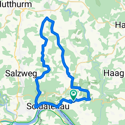
Obernzell-Oberachleiten-Kneiding- Schartenberg -Ingling - Passau - Kellber
A cycling route starting in Thyrnau, Bavaria, Germany.
Overview
About this route
- -:--
- Duration
- 55.2 km
- Distance
- 1,273 m
- Ascent
- 1,261 m
- Descent
- ---
- Avg. speed
- 640 m
- Max. altitude
Route quality
Waytypes & surfaces along the route
Waytypes
Quiet road
18.2 km
(33 %)
Road
16 km
(29 %)
Surfaces
Paved
21 km
(38 %)
Unpaved
4.4 km
(8 %)
Asphalt
20.4 km
(37 %)
Gravel
4.4 km
(8 %)
Continue with Bikemap
Use, edit, or download this cycling route
You would like to ride Obernzell-Oberachleiten-Kneiding- Schartenberg -Ingling - Passau - Kellber or customize it for your own trip? Here is what you can do with this Bikemap route:
Free features
- Save this route as favorite or in collections
- Copy & plan your own version of this route
- Sync your route with Garmin or Wahoo
Premium features
Free trial for 3 days, or one-time payment. More about Bikemap Premium.
- Navigate this route on iOS & Android
- Export a GPX / KML file of this route
- Create your custom printout (try it for free)
- Download this route for offline navigation
Discover more Premium features.
Get Bikemap PremiumFrom our community
Other popular routes starting in Thyrnau
 Obernzell-Oberachleiten-Kneiding- Schartenberg -Ingling - Passau - Kellber
- Distance
- 55.2 km
- Ascent
- 1,273 m
- Descent
- 1,261 m
- Location
- Thyrnau, Bavaria, Germany
 Steco 1
- Distance
- 48.6 km
- Ascent
- 771 m
- Descent
- 780 m
- Location
- Thyrnau, Bavaria, Germany
 Kellberg - Eugendorf
- Distance
- 119.4 km
- Ascent
- 932 m
- Descent
- 858 m
- Location
- Thyrnau, Bavaria, Germany
 Steco 4
- Distance
- 31.5 km
- Ascent
- 384 m
- Descent
- 380 m
- Location
- Thyrnau, Bavaria, Germany
 Steco 2
- Distance
- 50.3 km
- Ascent
- 842 m
- Descent
- 814 m
- Location
- Thyrnau, Bavaria, Germany
 Kellberg - Buechlberg - Runde CLONED FROM ROUTE 167495
- Distance
- 27.2 km
- Ascent
- 503 m
- Descent
- 503 m
- Location
- Thyrnau, Bavaria, Germany
 Kellberg - Klafferstrass-Kellberg
- Distance
- 87.1 km
- Ascent
- 1,894 m
- Descent
- 1,893 m
- Location
- Thyrnau, Bavaria, Germany
 Kellberg - Buechlberg - Runde
- Distance
- 27.2 km
- Ascent
- 503 m
- Descent
- 503 m
- Location
- Thyrnau, Bavaria, Germany
Open it in the app