

dans l'Ardèche verte
A cycling route starting in Annonay, Auvergne-Rhône-Alpes, France.
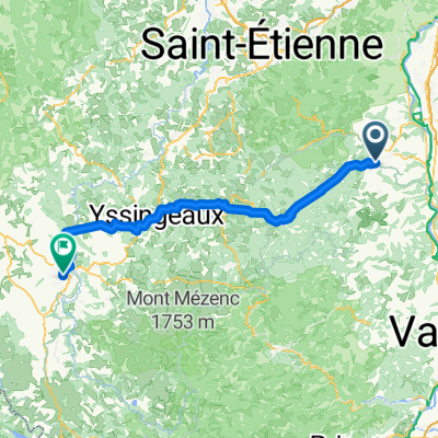
Overview
About this route
Loop around Annonay including the Col du Tracoulet, the Col de la Croix de Boiray, the Col de la Supyère and the Col de la Croix de Signolle (easy pushing), the Col du Rouvey, the Col des Baraques, the Col de la Clef and the Col du Feltin (easy pushing), the Col de la Charousse, the Collet, the Tracol, the Creux du Loup (R1 on GR) and finishing with the Col de Burdignes.
- -:--
- Duration
- 103.5 km
- Distance
- 1,734 m
- Ascent
- 1,736 m
- Descent
- ---
- Avg. speed
- ---
- Max. altitude
Route quality
Waytypes & surfaces along the route
Waytypes
Road
41.4 km
(40 %)
Quiet road
21.7 km
(21 %)
Surfaces
Paved
8.3 km
(8 %)
Unpaved
6.2 km
(6 %)
Paved (undefined)
4.1 km
(4 %)
Asphalt
4.1 km
(4 %)
Route highlights
Points of interest along the route
Point of interest after 14.4 km
Col de Burdignes
Point of interest after 25.4 km
Le Creux du Loup
Point of interest after 29.4 km
le Tracol
Point of interest after 36.2 km
Le Collet
Point of interest after 48.6 km
Col de la Charousse
Point of interest after 66.9 km
Col du Sapet
Point of interest after 68.9 km
Col des Baraques
Point of interest after 74.5 km
Col du Rouvey
Point of interest after 78.3 km
Col de la Clef
Point of interest after 79.7 km
Col de la Croix de Signolle
Point of interest after 81.8 km
Col de la Supyère
Point of interest after 83.7 km
Col de la Croix de Boiray
Point of interest after 95.1 km
Col du Tracoulet
Continue with Bikemap
Use, edit, or download this cycling route
You would like to ride dans l'Ardèche verte or customize it for your own trip? Here is what you can do with this Bikemap route:
Free features
- Save this route as favorite or in collections
- Copy & plan your own version of this route
- Split it into stages to create a multi-day tour
- Sync your route with Garmin or Wahoo
Premium features
Free trial for 3 days, or one-time payment. More about Bikemap Premium.
- Navigate this route on iOS & Android
- Export a GPX / KML file of this route
- Create your custom printout (try it for free)
- Download this route for offline navigation
Discover more Premium features.
Get Bikemap PremiumFrom our community
Other popular routes starting in Annonay
 2017 09 12 Annonay - Le Chambon
- Distance
- 48.2 km
- Ascent
- 1,014 m
- Descent
- 372 m
- Location
- Annonay, Auvergne-Rhône-Alpes, France
 Annonay Riotord
- Distance
- 70.5 km
- Ascent
- 1,607 m
- Descent
- 1,605 m
- Location
- Annonay, Auvergne-Rhône-Alpes, France
 Raid 707 - Section 1
- Distance
- 96.9 km
- Ascent
- 1,740 m
- Descent
- 1,653 m
- Location
- Annonay, Auvergne-Rhône-Alpes, France
 annonay-chanas
- Distance
- 19.1 km
- Ascent
- 167 m
- Descent
- 385 m
- Location
- Annonay, Auvergne-Rhône-Alpes, France
 Au coeur de l'Ardèche
- Distance
- 63 km
- Ascent
- 1,137 m
- Descent
- 1,108 m
- Location
- Annonay, Auvergne-Rhône-Alpes, France
 MTB Travers Ardeche
- Distance
- 301.7 km
- Ascent
- 2,755 m
- Descent
- 3,012 m
- Location
- Annonay, Auvergne-Rhône-Alpes, France
 Annonay-Le Puy en Velay(Jakobsweg)
- Distance
- 92.1 km
- Ascent
- 1,922 m
- Descent
- 1,623 m
- Location
- Annonay, Auvergne-Rhône-Alpes, France
 GTA_J1_Annonay_Villevocance
- Distance
- 17.6 km
- Ascent
- 433 m
- Descent
- 284 m
- Location
- Annonay, Auvergne-Rhône-Alpes, France
Open it in the app