

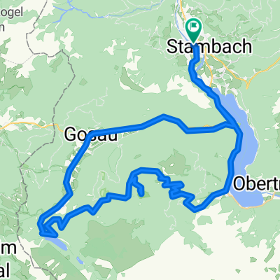
Salzkammergut Trophy Strecke/Track E 37,9 km / 1114 hm
A cycling route starting in Bad Goisern am Hallstättersee, Upper Austria, Austria.
Overview
About this route
- "Light"-Strecke E der Salzkammergut
Trophy
-
37,9 km, 1114 hm
-
großteils Schotterstraße, Forststraße, tw. Asphaltstraße, Wiesen-/Waldweg
- -:--
- Duration
- 37.6 km
- Distance
- 955 m
- Ascent
- 954 m
- Descent
- ---
- Avg. speed
- ---
- Avg. speed
Route quality
Waytypes & surfaces along the route
Waytypes
Track
17.9 km
(47 %)
Road
7.9 km
(21 %)
Surfaces
Paved
14.7 km
(39 %)
Unpaved
19 km
(51 %)
Asphalt
11.5 km
(31 %)
Gravel
9.1 km
(24 %)
Continue with Bikemap
Use, edit, or download this cycling route
You would like to ride Salzkammergut Trophy Strecke/Track E 37,9 km / 1114 hm or customize it for your own trip? Here is what you can do with this Bikemap route:
Free features
- Save this route as favorite or in collections
- Copy & plan your own version of this route
- Sync your route with Garmin or Wahoo
Premium features
Free trial for 3 days, or one-time payment. More about Bikemap Premium.
- Navigate this route on iOS & Android
- Export a GPX / KML file of this route
- Create your custom printout (try it for free)
- Download this route for offline navigation
Discover more Premium features.
Get Bikemap PremiumFrom our community
Other popular routes starting in Bad Goisern am Hallstättersee
 Hallstatt-Altausee-BadIschl-Hallstatt
- Distance
- 59.8 km
- Ascent
- 612 m
- Descent
- 612 m
- Location
- Bad Goisern am Hallstättersee, Upper Austria, Austria
 Zur Blaa-Alm
- Distance
- 45.3 km
- Ascent
- 846 m
- Descent
- 849 m
- Location
- Bad Goisern am Hallstättersee, Upper Austria, Austria
 Salzkammer 1 den
- Distance
- 62.7 km
- Ascent
- 1,703 m
- Descent
- 1,703 m
- Location
- Bad Goisern am Hallstättersee, Upper Austria, Austria
 Weißenbach-Runde_Agatha rechtshin_linkszurück
- Distance
- 27.3 km
- Ascent
- 836 m
- Descent
- 818 m
- Location
- Bad Goisern am Hallstättersee, Upper Austria, Austria
 Jezera Solné komory: Hallstätter See a Vorderer Gosausee CLONED FROM ROUTE 759999
- Distance
- 46.9 km
- Ascent
- 1,563 m
- Descent
- 1,563 m
- Location
- Bad Goisern am Hallstättersee, Upper Austria, Austria
 Hallstatt - RosAlm
- Distance
- 36.5 km
- Ascent
- 1,717 m
- Descent
- 1,726 m
- Location
- Bad Goisern am Hallstättersee, Upper Austria, Austria
 Hallstatt - Ennsradweg - Prag - 2014
- Distance
- 668.7 km
- Ascent
- 1,491 m
- Descent
- 1,751 m
- Location
- Bad Goisern am Hallstättersee, Upper Austria, Austria
 Okruh HSee
- Distance
- 22.9 km
- Ascent
- 294 m
- Descent
- 294 m
- Location
- Bad Goisern am Hallstättersee, Upper Austria, Austria
Open it in the app