
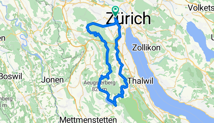
Zürich - Albispass - Buchenegg - Uetliberg - Zürich
A cycling route starting in Zürich (Kreis 4) / Aussersihl, Canton of Zurich, Switzerland.
Overview
About this route
3.4.2011
mit Johannes
- -:--
- Duration
- 41.7 km
- Distance
- 702 m
- Ascent
- 699 m
- Descent
- ---
- Avg. speed
- ---
- Avg. speed
Route quality
Waytypes & surfaces along the route
Waytypes
Track
11.9 km
(28 %)
Busy road
10.2 km
(24 %)
Surfaces
Paved
29.2 km
(70 %)
Unpaved
10.6 km
(26 %)
Asphalt
28.5 km
(68 %)
Gravel
10.1 km
(24 %)
Continue with Bikemap
Use, edit, or download this cycling route
You would like to ride Zürich - Albispass - Buchenegg - Uetliberg - Zürich or customize it for your own trip? Here is what you can do with this Bikemap route:
Free features
- Save this route as favorite or in collections
- Copy & plan your own version of this route
- Sync your route with Garmin or Wahoo
Premium features
Free trial for 3 days, or one-time payment. More about Bikemap Premium.
- Navigate this route on iOS & Android
- Export a GPX / KML file of this route
- Create your custom printout (try it for free)
- Download this route for offline navigation
Discover more Premium features.
Get Bikemap PremiumFrom our community
Other popular routes starting in Zürich (Kreis 4) / Aussersihl
 abendrunde heitersberg
- Distance
- 44.9 km
- Ascent
- 551 m
- Descent
- 551 m
- Location
- Zürich (Kreis 4) / Aussersihl, Canton of Zurich, Switzerland
 Züri-Sattelegg-Züri
- Distance
- 104.7 km
- Ascent
- 924 m
- Descent
- 921 m
- Location
- Zürich (Kreis 4) / Aussersihl, Canton of Zurich, Switzerland
 Üetliberg umfahren
- Distance
- 31.1 km
- Ascent
- 473 m
- Descent
- 473 m
- Location
- Zürich (Kreis 4) / Aussersihl, Canton of Zurich, Switzerland
 bike tour from Zürich to Bonstetten
- Distance
- 16.7 km
- Ascent
- 311 m
- Descent
- 183 m
- Location
- Zürich (Kreis 4) / Aussersihl, Canton of Zurich, Switzerland
 Hügelrunde-Süd Februar
- Distance
- 69 km
- Ascent
- 778 m
- Descent
- 777 m
- Location
- Zürich (Kreis 4) / Aussersihl, Canton of Zurich, Switzerland
 Bäcki-Türlersee-Ägerisee-Gottschalkenberg-Hirzel-Bäcki
- Distance
- 85 km
- Ascent
- 1,052 m
- Descent
- 1,049 m
- Location
- Zürich (Kreis 4) / Aussersihl, Canton of Zurich, Switzerland
 Zurich - Rapperswil
- Distance
- 31.4 km
- Ascent
- 134 m
- Descent
- 101 m
- Location
- Zürich (Kreis 4) / Aussersihl, Canton of Zurich, Switzerland
 Türlersee Rundfahrt
- Distance
- 51.9 km
- Ascent
- 637 m
- Descent
- 644 m
- Location
- Zürich (Kreis 4) / Aussersihl, Canton of Zurich, Switzerland
Open it in the app