Kelleys 1
A cycling route starting in Sandusky, Ohio, United States.
Overview
About this route
- -:--
- Duration
- 21.2 km
- Distance
- 62 m
- Ascent
- 66 m
- Descent
- ---
- Avg. speed
- ---
- Max. altitude
Route quality
Waytypes & surfaces along the route
Waytypes
Road
9.9 km
(47 %)
Access road
2.5 km
(12 %)
Surfaces
Paved
16.7 km
(79 %)
Asphalt
16.1 km
(76 %)
Paved (undefined)
0.4 km
(2 %)
Route highlights
Points of interest along the route
Point of interest after 0.5 km
inscription rock
Point of interest after 6.8 km
historical museum
Point of interest after 8.6 km
beech and boat launch
Point of interest after 9.1 km
picnic area
Point of interest after 9.1 km
glassier groves
Point of interest after 11.1 km
west bay stop for pictures
Point of interest after 14 km
quarry
Point of interest after 21.1 km
start at ferry
Continue with Bikemap
Use, edit, or download this cycling route
You would like to ride Kelleys 1 or customize it for your own trip? Here is what you can do with this Bikemap route:
Free features
- Save this route as favorite or in collections
- Copy & plan your own version of this route
- Sync your route with Garmin or Wahoo
Premium features
Free trial for 3 days, or one-time payment. More about Bikemap Premium.
- Navigate this route on iOS & Android
- Export a GPX / KML file of this route
- Create your custom printout (try it for free)
- Download this route for offline navigation
Discover more Premium features.
Get Bikemap PremiumFrom our community
Other popular routes starting in Sandusky
santwon- Distance
- 9.1 km
- Ascent
- 22 m
- Descent
- 22 m
- Location
- Sandusky, Ohio, United States
226 Vine Ave, Lakeside Marblehead to 201–299 Vine Ave, Lakeside Marblehead- Distance
- 2.4 km
- Ascent
- 52 m
- Descent
- 49 m
- Location
- Sandusky, Ohio, United States
Kelleys Island Loop- Distance
- 14 km
- Ascent
- 54 m
- Descent
- 52 m
- Location
- Sandusky, Ohio, United States
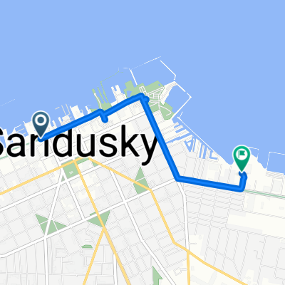
East Washington Row 115, Sandusky to West Shoreline Drive 109, Sandusky- Distance
- 10.9 km
- Ascent
- 41 m
- Descent
- 13 m
- Location
- Sandusky, Ohio, United States
Kelly island- Distance
- 45.8 km
- Ascent
- 137 m
- Descent
- 145 m
- Location
- Sandusky, Ohio, United States
Sprucewood Dr, Sandusky to 133 E Water St, Sandusky- Distance
- 7.2 km
- Ascent
- 10 m
- Descent
- 7 m
- Location
- Sandusky, Ohio, United States
Kelleys 1- Distance
- 21.2 km
- Ascent
- 62 m
- Descent
- 66 m
- Location
- Sandusky, Ohio, United States
lakeside to new riegel- Distance
- 96.6 km
- Ascent
- 93 m
- Descent
- 29 m
- Location
- Sandusky, Ohio, United States
Open it in the app


