

Día 1 San Lorenzo
A cycling route starting in Mazatenango, Suchitepeque, Guatemala.
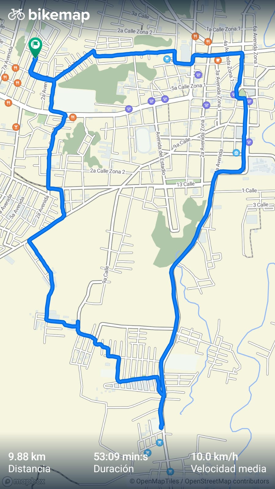
Overview
About this route
- 1 h 22 min
- Duration
- 7.9 km
- Distance
- 0 m
- Ascent
- 231 m
- Descent
- 5.8 km/h
- Avg. speed
- ---
- Max. altitude

Route photos

Route quality
Waytypes & surfaces along the route
Waytypes
Quiet road
4.9 km
(62 %)
Road
2.8 km
(35 %)
Surfaces
Paved
3.7 km
(47 %)
Asphalt
2.8 km
(36 %)
Concrete
0.9 km
(11 %)
Undefined
4.2 km
(53 %)
Continue with Bikemap
Use, edit, or download this cycling route
You would like to ride Día 1 San Lorenzo or customize it for your own trip? Here is what you can do with this Bikemap route:
Free features
- Save this route as favorite or in collections
- Copy & plan your own version of this route
- Sync your route with Garmin or Wahoo
Premium features
Free trial for 3 days, or one-time payment. More about Bikemap Premium.
- Navigate this route on iOS & Android
- Export a GPX / KML file of this route
- Create your custom printout (try it for free)
- Download this route for offline navigation
Discover more Premium features.
Get Bikemap PremiumFrom our community
Other popular routes starting in Mazatenango
 Día 1 San Lorenzo
- Distance
- 7.9 km
- Ascent
- 0 m
- Descent
- 231 m
- Location
- Mazatenango, Suchitepeque, Guatemala
 Paseo lento en Mazatenango
- Distance
- 8.2 km
- Ascent
- 141 m
- Descent
- 129 m
- Location
- Mazatenango, Suchitepeque, Guatemala
 Ruta relajada
- Distance
- 10.7 km
- Ascent
- 166 m
- Descent
- 167 m
- Location
- Mazatenango, Suchitepeque, Guatemala
 Paseo intenso en Mazatenango
- Distance
- 4.5 km
- Ascent
- 24 m
- Descent
- 135 m
- Location
- Mazatenango, Suchitepeque, Guatemala
 Paseo rápido en Santo Domingo Suchitepéquez
- Distance
- 12 km
- Ascent
- 95 m
- Descent
- 233 m
- Location
- Mazatenango, Suchitepeque, Guatemala
 sambo
sambo- Distance
- 40.6 km
- Ascent
- 578 m
- Descent
- 564 m
- Location
- Mazatenango, Suchitepeque, Guatemala
 E42A–Mazatenango–San Sebastien–Retalhuleu–Coatepaeque
- Distance
- 61.8 km
- Ascent
- 842 m
- Descent
- 720 m
- Location
- Mazatenango, Suchitepeque, Guatemala
 E42–Mazatenango–San Sebastien–Retalhuleu–Coatepaeque
- Distance
- 66 km
- Ascent
- 1,150 m
- Descent
- 1,028 m
- Location
- Mazatenango, Suchitepeque, Guatemala
Open it in the app