

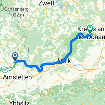
Panholz 17 nach Panholz 17
A cycling route starting in Bad Kreuzen, Upper Austria, Austria.
Overview
About this route
- 6 h 49 min
- Duration
- 35.9 km
- Distance
- 718 m
- Ascent
- 648 m
- Descent
- 5.3 km/h
- Avg. speed
- ---
- Max. altitude

Route photos


Route quality
Waytypes & surfaces along the route
Waytypes
Quiet road
14.3 km
(40 %)
Track
3.9 km
(11 %)
Surfaces
Paved
8.6 km
(24 %)
Unpaved
1.8 km
(5 %)
Asphalt
8.6 km
(24 %)
Gravel
0.7 km
(2 %)
Continue with Bikemap
Use, edit, or download this cycling route
You would like to ride Panholz 17 nach Panholz 17 or customize it for your own trip? Here is what you can do with this Bikemap route:
Free features
- Save this route as favorite or in collections
- Copy & plan your own version of this route
- Sync your route with Garmin or Wahoo
Premium features
Free trial for 3 days, or one-time payment. More about Bikemap Premium.
- Navigate this route on iOS & Android
- Export a GPX / KML file of this route
- Create your custom printout (try it for free)
- Download this route for offline navigation
Discover more Premium features.
Get Bikemap PremiumFrom our community
Other popular routes starting in Bad Kreuzen
 Donauradweg - 6 day (Grein - Klam - Grein)
- Distance
- 22.3 km
- Ascent
- 285 m
- Descent
- 285 m
- Location
- Bad Kreuzen, Upper Austria, Austria
 Donau_Etappe_04_Grein-Melk
- Distance
- 47.9 km
- Ascent
- 155 m
- Descent
- 179 m
- Location
- Bad Kreuzen, Upper Austria, Austria
 Grein - Krems
- Distance
- 87.1 km
- Ascent
- 541 m
- Descent
- 573 m
- Location
- Bad Kreuzen, Upper Austria, Austria
 Track 3
- Distance
- 106.5 km
- Ascent
- 864 m
- Descent
- 1,128 m
- Location
- Bad Kreuzen, Upper Austria, Austria
 Tour de Alm Road 6
- Distance
- 17.5 km
- Ascent
- 347 m
- Descent
- 577 m
- Location
- Bad Kreuzen, Upper Austria, Austria
 Grein 3 Flüsse Rund Wallsee Ardagger Grein
- Distance
- 74.2 km
- Ascent
- 45 m
- Descent
- 41 m
- Location
- Bad Kreuzen, Upper Austria, Austria
 Donau_Etappe_04_Grein-Melk
- Distance
- 51.2 km
- Ascent
- 181 m
- Descent
- 203 m
- Location
- Bad Kreuzen, Upper Austria, Austria
 Panholz 17 nach Panholz 17
- Distance
- 35.9 km
- Ascent
- 718 m
- Descent
- 648 m
- Location
- Bad Kreuzen, Upper Austria, Austria
Open it in the app