

HVL Wustermark→Nauen 48km
A cycling route starting in Wustermark, Brandenburg, Germany.
Overview
About this route
L: ++ ; S: o
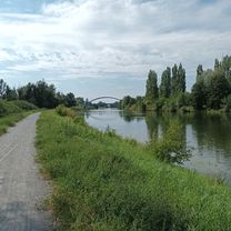
Summary: The landscape is consistently great, the route is occasionally challenging.
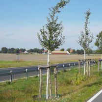
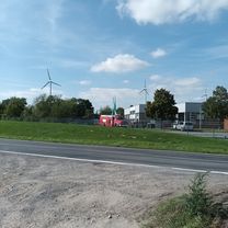
From Wustermark to Tremmen, initially sandy but rideable, then trafficked but bearable.
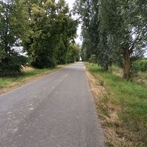
From Tremmen it improves, and from Niebede to Wachow might be the highlight. From Wachow pay attention to the changed route (Friedr.Eng-Str / blue).
From the campsite to Päwesin rather unpleasantly sandy. From Päwesin a nice road with cars. From Riewend very quiet, but road surface made of yellow bricks (!!). After two to three kilometers, then peaceful riding up to the familiar path via G.Behnitz and Ribbeck.
Changed: From Wachow to Päwesin the (marked) path via 'Zum See' was pure horror. In front of the campsite there is a cyclist signpost indicating the now chosen route (?).
- -:--
- Duration
- 46.4 km
- Distance
- 83 m
- Ascent
- 83 m
- Descent
- ---
- Avg. speed
- 48 m
- Max. altitude

Route quality
Waytypes & surfaces along the route
Waytypes
Track
15.8 km
(34 %)
Quiet road
15.3 km
(33 %)
Surfaces
Paved
30.2 km
(65 %)
Unpaved
6 km
(13 %)
Asphalt
30.2 km
(65 %)
Gravel
4.2 km
(9 %)
Continue with Bikemap
Use, edit, or download this cycling route
You would like to ride HVL Wustermark→Nauen 48km or customize it for your own trip? Here is what you can do with this Bikemap route:
Free features
- Save this route as favorite or in collections
- Copy & plan your own version of this route
- Sync your route with Garmin or Wahoo
Premium features
Free trial for 3 days, or one-time payment. More about Bikemap Premium.
- Navigate this route on iOS & Android
- Export a GPX / KML file of this route
- Create your custom printout (try it for free)
- Download this route for offline navigation
Discover more Premium features.
Get Bikemap PremiumFrom our community
Other popular routes starting in Wustermark
 Sonntagsausfahrt 17.09.23
- Distance
- 48.3 km
- Ascent
- 357 m
- Descent
- 412 m
- Location
- Wustermark, Brandenburg, Germany
 Havellandrunde 1
- Distance
- 34.9 km
- Ascent
- 57 m
- Descent
- 59 m
- Location
- Wustermark, Brandenburg, Germany
 Route nach Unter den Kiefern 1, Wustermark über GVZ Wustermark, Falkensee
- Distance
- 17.3 km
- Ascent
- 88 m
- Descent
- 126 m
- Location
- Wustermark, Brandenburg, Germany
 Unter den Kiefern 7a, Wustermark nach Hennigsdorf Bhf. über Potsdam
- Distance
- 54.8 km
- Ascent
- 303 m
- Descent
- 311 m
- Location
- Wustermark, Brandenburg, Germany
 Unter den Kiefern 7a nach Unter den Kiefern 7a
- Distance
- 42.5 km
- Ascent
- 175 m
- Descent
- 215 m
- Location
- Wustermark, Brandenburg, Germany
 Unter den Kiefern 7a nach Unter den Kiefern
- Distance
- 40.9 km
- Ascent
- 330 m
- Descent
- 331 m
- Location
- Wustermark, Brandenburg, Germany
 Unter den Kiefern nach Fahrländer Chaussee
- Distance
- 45.6 km
- Ascent
- 277 m
- Descent
- 339 m
- Location
- Wustermark, Brandenburg, Germany
 Route nach Unter den Kiefern 7a
- Distance
- 45.3 km
- Ascent
- 337 m
- Descent
- 382 m
- Location
- Wustermark, Brandenburg, Germany
Open it in the app