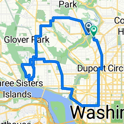
The White House, Lincoln Memorial and Rock Creek Park
- 15 km
- 187 m
- 187 m
- Washington D.C., District of Columbia, United States
A cycling route starting in Washington D.C., District of Columbia, United States.
Overview
Logan -> Crescent -> Glover Park -> AdMo
created this 4 years ago
Route quality
Quiet road
7.3 km
(49 %)
Cycleway
3.7 km
(25 %)
Paved
12.8 km
(86 %)
Unpaved
1 km
(7 %)
Asphalt
12.2 km
(82 %)
Unpaved (undefined)
1 km
(7 %)
Continue with Bikemap
You would like to ride Crescent Trail Morning Ride or customize it for your own trip? Here is what you can do with this Bikemap route:
Free trial for 3 days, or one-time payment. More about Bikemap Premium.
Discover more Premium features.
Get Bikemap PremiumFrom our community
Open it in the app