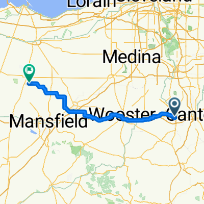
Towpath 40 miles

A cycling route starting in Massillon, Ohio, United States.
OverviewAbout this route
-:--
Duration
32.4 km
Distance
66 m
Ascent
56 m
Descent
---
Avg. speed
---
Max. altitude
Julie Hershbergercreated this 4 years ago
Route qualityWaytypes & surfaces along the route
Waytypes
  • Cycleway

    32.1 km99 %
  • Undefined

    0.3 km1 %
Surfaces

Paved

2.3 km(7 %)

Unpaved

10.7 km(33 %)
  • Loose gravel

    10.7 km33 %
  • Paved (undefined)

    1.6 km5 %
  • Wood

    0.6 km2 %
Continue with BikemapUse, edit, or download this cycling route
You would like to ride Towpath 40 miles or customize it for your own trip? Here is what you can do with this Bikemap route:
Free features
Premium features

Free trial for 3 days, or one-time payment. More about Bikemap Premium.

  • Navigate this route on iOS & Android
  • Export a GPX / KML file of this route
  • Create your custom printout (try it for free)
  • Download this route for offline navigation

Discover more Premium features.

Get Bikemap Premium
From our communityOther popular routes starting in Massillon

Open it in the app