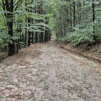
A Borsó- és a Gergely-hegy titkai
A cycling route starting in Gönc, Borsod-Abauj Zemplen county, Hungary.
Overview
About this route
What lies within the volcanic region, the dense forests beyond the peaks, can truly only be discovered by experiencing it personally. It may also happen that we return with even more questions, and only after a thorough exploration can we form a picture of the mysterious, ancient land. When we hear the call of the wild, the howling of wolves from the inner regions, the mating song of the stags, the raven bickering with its mate, or the whistling of the north wind through the beech forest of Borsó Hill, the sounds of the unknown world fill us with chilling curiosity. Whether we choose to seek answers to these questions is up to us, but taking a glimpse into the unknown is definitely interesting and worthwhile.
- 1 h 28 min
- Duration
- 14.6 km
- Distance
- 593 m
- Ascent
- 595 m
- Descent
- 9.9 km/h
- Avg. speed
- ---
- Max. altitude
Continue with Bikemap
Use, edit, or download this cycling route
You would like to ride A Borsó- és a Gergely-hegy titkai or customize it for your own trip? Here is what you can do with this Bikemap route:
Free features
- Save this route as favorite or in collections
- Copy & plan your own version of this route
- Sync your route with Garmin or Wahoo
Premium features
Free trial for 3 days, or one-time payment. More about Bikemap Premium.
- Navigate this route on iOS & Android
- Export a GPX / KML file of this route
- Create your custom printout (try it for free)
- Download this route for offline navigation
Discover more Premium features.
Get Bikemap PremiumFrom our community
Other popular routes starting in Gönc
 Múzeum út 8a., Telkibánya to Múzeum út 11., Telkibánya
- Distance
- 37.7 km
- Ascent
- 970 m
- Descent
- 980 m
- Location
- Gönc, Borsod-Abauj Zemplen county, Hungary
 A Borsó- és a Gergely-hegy titkai
- Distance
- 14.6 km
- Ascent
- 593 m
- Descent
- 595 m
- Location
- Gönc, Borsod-Abauj Zemplen county, Hungary
 18.4 TOURING VISSZA PÁlháza-Pusztaf-IZRA-tó-Füzér-Hollóh-Aszfalt
- Distance
- 27.5 km
- Ascent
- 408 m
- Descent
- 566 m
- Location
- Gönc, Borsod-Abauj Zemplen county, Hungary
 Telkibánya 38 km-es kör
- Distance
- 37.8 km
- Ascent
- 559 m
- Descent
- 559 m
- Location
- Gönc, Borsod-Abauj Zemplen county, Hungary
 Pálháza 30km körút
- Distance
- 14.2 km
- Ascent
- 80 m
- Descent
- 388 m
- Location
- Gönc, Borsod-Abauj Zemplen county, Hungary
 Kőkapu 2
- Distance
- 13 km
- Ascent
- 434 m
- Descent
- 433 m
- Location
- Gönc, Borsod-Abauj Zemplen county, Hungary
 STEREO 10.2 Kőkapu-Pálháza
- Distance
- 8.5 km
- Ascent
- 25 m
- Descent
- 101 m
- Location
- Gönc, Borsod-Abauj Zemplen county, Hungary
 ROMANIA 2011 - 2 day
- Distance
- 120.7 km
- Ascent
- 181 m
- Descent
- 210 m
- Location
- Gönc, Borsod-Abauj Zemplen county, Hungary
Open it in the app


