

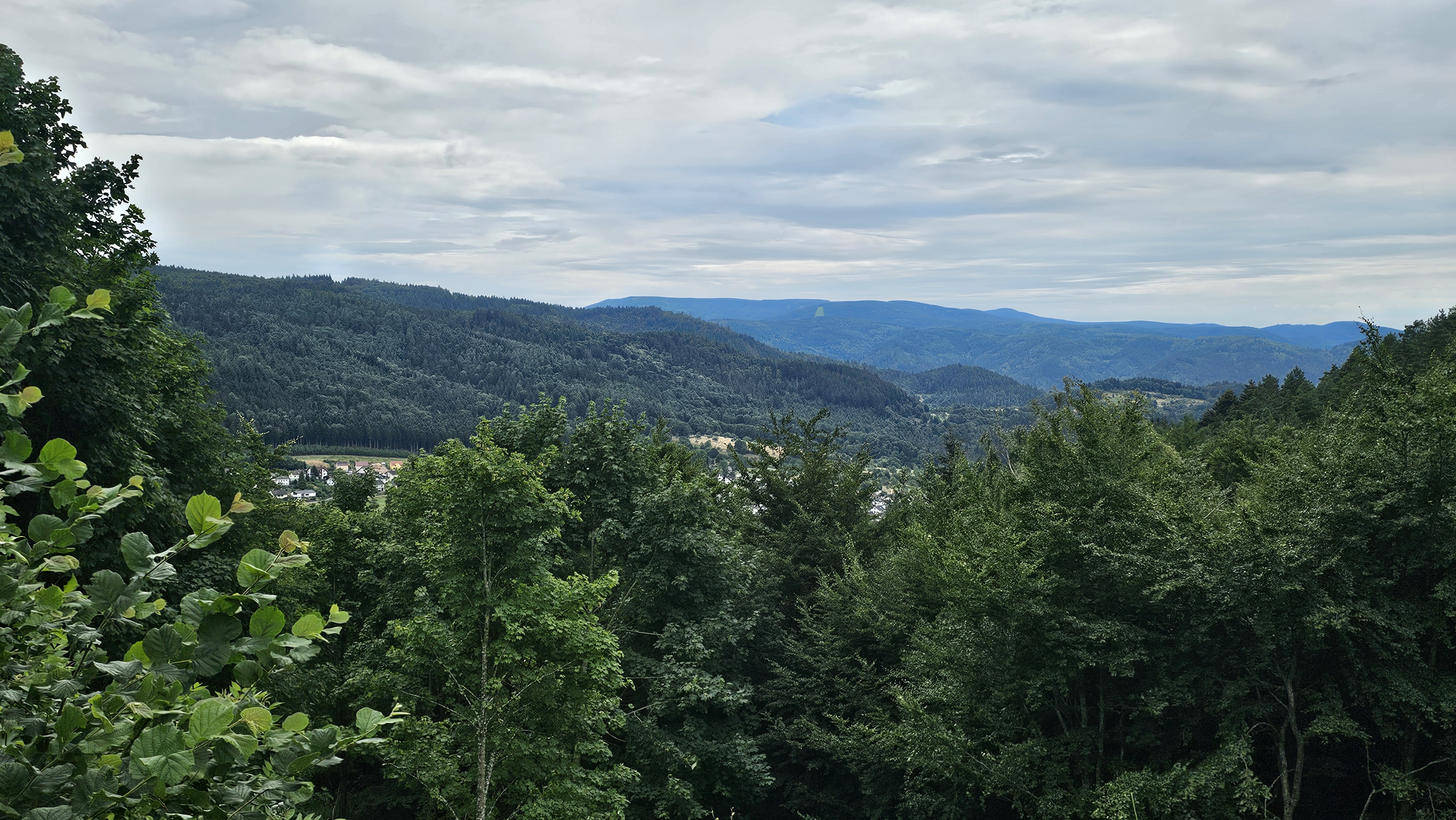
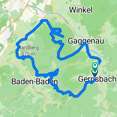
Vier-Wälder-Tour - Mit dem Mountainbike zur Nachtigall
A cycling route starting in Gernsbach, Baden-Wurttemberg, Germany.
Overview
About this route
Gernsbach - Obertsrot - Lindel - Nachtigall - Staufenberg - Gernsbach
- 1 h 28 min
- Duration
- 21.7 km
- Distance
- 790 m
- Ascent
- 789 m
- Descent
- 14.9 km/h
- Avg. speed
- ---
- Max. altitude
Continue with Bikemap
Use, edit, or download this cycling route
You would like to ride Vier-Wälder-Tour - Mit dem Mountainbike zur Nachtigall or customize it for your own trip? Here is what you can do with this Bikemap route:
Free features
- Save this route as favorite or in collections
- Copy & plan your own version of this route
- Sync your route with Garmin or Wahoo
Premium features
Free trial for 3 days, or one-time payment. More about Bikemap Premium.
- Navigate this route on iOS & Android
- Export a GPX / KML file of this route
- Create your custom printout (try it for free)
- Download this route for offline navigation
Discover more Premium features.
Get Bikemap PremiumFrom our community
Other popular routes starting in Gernsbach
 Gernsbach - Teufelsmühle - Forbach - Gernsbach
- Distance
- 35.7 km
- Ascent
- 931 m
- Descent
- 928 m
- Location
- Gernsbach, Baden-Wurttemberg, Germany
 urlaubsvorbereitungen Gernsbach
- Distance
- 38.6 km
- Ascent
- 1,220 m
- Descent
- 1,219 m
- Location
- Gernsbach, Baden-Wurttemberg, Germany
 22.Juli 2023
- Distance
- 28.7 km
- Ascent
- 593 m
- Descent
- 639 m
- Location
- Gernsbach, Baden-Wurttemberg, Germany
 Arbeitsweg kurz (home-benzwerk gaggenau)
- Distance
- 7 km
- Ascent
- 89 m
- Descent
- 148 m
- Location
- Gernsbach, Baden-Wurttemberg, Germany
 Arbeitsweg lang Scheuern - Merkur-Luisebrunnen-Gaggenau
- Distance
- 20.9 km
- Ascent
- 656 m
- Descent
- 712 m
- Location
- Gernsbach, Baden-Wurttemberg, Germany
 Hördener Straße nach Hördener Straße
- Distance
- 30.5 km
- Ascent
- 670 m
- Descent
- 721 m
- Location
- Gernsbach, Baden-Wurttemberg, Germany
 Weinauer Straße nach Weinauer Straße c
- Distance
- 49.9 km
- Ascent
- 1,397 m
- Descent
- 1,401 m
- Location
- Gernsbach, Baden-Wurttemberg, Germany
 Schwarzwaldrunde
- Distance
- 64.9 km
- Ascent
- 1,898 m
- Descent
- 1,523 m
- Location
- Gernsbach, Baden-Wurttemberg, Germany
Open it in the app