Eindhoven
A cycling route starting in 't Hofke, North Brabant, Netherlands.
Overview
About this route
From: 't Hofke 82, 5641AS Eindhoven, North Brabant, Netherlands To: 't Hofke 82, 5641AS Eindhoven, North Brabant, Netherlands Routing: Race cycling - nicest
- 2 h 7 min
- Duration
- 35.1 km
- Distance
- 37 m
- Ascent
- 35 m
- Descent
- 16.6 km/h
- Avg. speed
- ---
- Avg. speed
Route quality
Waytypes & surfaces along the route
Waytypes
Quiet road
20.7 km
(59 %)
Cycleway
11.5 km
(33 %)
Surfaces
Paved
25.4 km
(72 %)
Unpaved
0 km
(<1 %)
Asphalt
23.5 km
(67 %)
Paving stones
1.9 km
(5 %)
Continue with Bikemap
Use, edit, or download this cycling route
You would like to ride Eindhoven or customize it for your own trip? Here is what you can do with this Bikemap route:
Free features
- Save this route as favorite or in collections
- Copy & plan your own version of this route
- Sync your route with Garmin or Wahoo
Premium features
Free trial for 3 days, or one-time payment. More about Bikemap Premium.
- Navigate this route on iOS & Android
- Export a GPX / KML file of this route
- Create your custom printout (try it for free)
- Download this route for offline navigation
Discover more Premium features.
Get Bikemap PremiumFrom our community
Other popular routes starting in 't Hofke
- 32 km - Route door Eindhoven
- Distance
- 31.8 km
- Ascent
- 26 m
- Descent
- 28 m
- Location
- 't Hofke, North Brabant, Netherlands
- 30 km - Rond Ehv airport
- Distance
- 30.3 km
- Ascent
- 18 m
- Descent
- 17 m
- Location
- 't Hofke, North Brabant, Netherlands
- 39.km.son.boskant.liempde.best.ehv
- Distance
- 38.8 km
- Ascent
- 31 m
- Descent
- 35 m
- Location
- 't Hofke, North Brabant, Netherlands
- 45.km-ehv.centrum-veldhvn-vessem-airport-ehv.nrd_cw
- Distance
- 45.1 km
- Ascent
- 79 m
- Descent
- 79 m
- Location
- 't Hofke, North Brabant, Netherlands
- Eindhoven Luytelaer - Broekhuizenvorst thuis
- Distance
- 52.1 km
- Ascent
- 22 m
- Descent
- 24 m
- Location
- 't Hofke, North Brabant, Netherlands
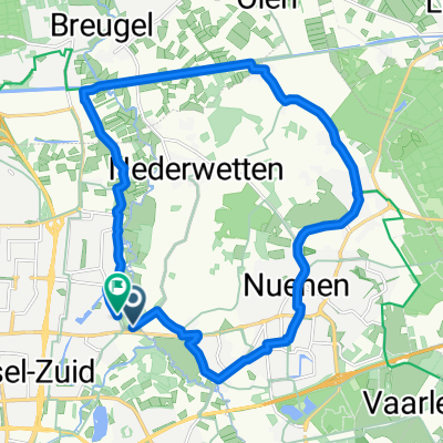
- Eindhoven-Kluis-Best-Eindhoven 70km
- Distance
- 70.3 km
- Ascent
- 50 m
- Descent
- 48 m
- Location
- 't Hofke, North Brabant, Netherlands
- 28 km - Rondje Woensel-Noord
- Distance
- 28.2 km
- Ascent
- 15 m
- Descent
- 14 m
- Location
- 't Hofke, North Brabant, Netherlands
- 30.km.liberation.route.son
- Distance
- 29.5 km
- Ascent
- 28 m
- Descent
- 29 m
- Location
- 't Hofke, North Brabant, Netherlands
Open it in the app